How did Roman soldiers divide up the work of building the Antonine Wall? Its distance slabs record the achievements of the legions, but matching their inscriptions to actual stretches of the frontier is not straightforward.
A 2026 study by W. S. Hanson and N. Hannon, published in Britannia, re-examines that relationship. Combining three-dimensional landscape measurements with evidence about where the stones were found, the authors offer a revised account of how parts of the Wall were measured and built.
Measuring across an uneven landscape
A distance measured on a flat map does not include the extra ground covered when a route climbs and descends. LiDAR, a laser-surveying technique, allows researchers to model those changes in height along the Wall.
The study gives a revised three-dimensional length of approximately 62.8 kilometres for the frontier. This incorporates adjustments to its reconstructed course as well as the effects of the terrain. It should therefore be understood as a survey-based estimate, rather than an exact measurement of an entirely surviving monument.
Roman feet, paces and miles
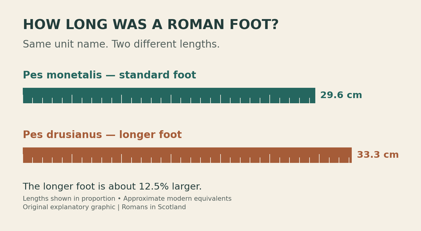
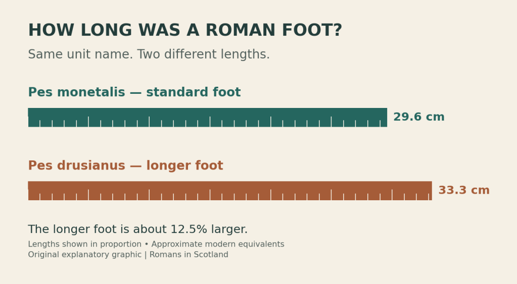
The unfamiliar names refer to two different lengths of “foot”. The pes monetalis was the standard Roman foot, about 29.6 centimetres long. The pes drusianus was a longer foot, about 33.3 centimetres. Think of two rulers, both labelled “one foot”, but with one longer than the other.
Imagine two surveyors measuring out 100 feet. With the shorter ruler, the distance would be 29.6 metres; with the longer ruler, it would be 33.3 metres. Both surveyors would call their result “100 feet”, but their finishing points would be 3.7 metres apart.
That is the problem when interpreting the distance slabs: the inscriptions give a number of feet or paces, but do not specify which length of foot underlies the calculation.
A Roman pace (passus) was a double step, formally equal to five feet. A Roman mile contained 1,000 such paces, or 5,000 feet. The two foot standards considered in the study produce the following approximate conversions:
| Unit | Using the pes Monetalis | Using the pes Drusianus |
|---|---|---|
| One foot | 29.6 cm | 33.3 cm |
| One pace: five feet | 1.480 m | 1.665 m |
| One mile: 1,000 paces | 1,480 m | 1,665 m |
These figures use the rounded foot lengths adopted in the paper. The longer Drusian foot was one-eighth larger than the standard Monetalis foot: a difference of about 12.5 per cent.
The westernmost building sections, between Castlehill and the Clyde, were recorded on their slabs in feet; other surviving records generally use paces. That change of unit does not itself imply a change in the length of the foot.
Hanson and Hannon conclude that the inscriptions used the pes Monetalis, revising an earlier interpretation favouring the pes Drusianus. For example, 3,000 feet would represent approximately 888 metres under the shorter standard, but 999 metres under the longer one. Choosing the wrong standard therefore shifts the proposed boundaries of the legionary work sections substantially. This is a correction to our interpretation of the measurements, not evidence that the Romans changed rulers halfway through building the Wall.
Forts already standing along the route
To compare the inscriptions with the landscape, the researchers also consider structures already occupying part of the Wall’s line. A stretch of frontage belonging to an existing fort would not necessarily represent new rampart built by the workforce responsible for the adjoining section.
The clearest named examples in the authors’ distance-based test are Bearsden, Cadder and Kirkintilloch. Deducting their frontages as if they had already existed would make the measured distance too short to match the inscriptions. The authors therefore argue that these forts were probably added after the rampart in this part of the Wall had been built.
This is supporting evidence, rather than a directly excavated sequence at all three sites. The paper notes that the structural relationship with the Wall has not been established at Bearsden or Kirkintilloch, while the evidence at Cadder is more complicated.
The authors also describe Westerwood and Inveravon as secondary forts. However, their paper does not provide an equally detailed measurement test for every fort along the frontier.
Castlehill and Duntocher require a different explanation. Both replaced earlier fortlets and are therefore interpreted as additions to the original plan, yet the forts themselves were built before the connecting Wall rampart reached them. “Secondary” can thus mean a change to the original scheme; it does not invariably mean a fort constructed after the adjoining rampart.
For comparison, the five forts on the Wall’s line which the paper identifies as primary are Old Kilpatrick, Balmuildy, Auchendavy, Castlecary and Mumrills. Carriden lay beyond the eastern end of the linear barrier and is discussed separately.
The wider interpretation of a major change in the frontier’s design remains debated. These results support the authors’ reconstruction without establishing precise construction dates for the individual additions.
The smaller fortlets show a more varied sequence. The authors regard them as part of the original plan, but argue that their construction did not proceed in the same way everywhere. Some western fortlets stood before the connecting rampart was built; in the easternmost sector, fortlets and rampart appear to have been constructed together.
More than one starting point?
The study supports an early start on the eastern section between Bridgeness and the River Avon. However, this need not mean that construction advanced as a single operation steadily moving westwards.
Hanson and Hannon suggest that work may also have begun beside the road crossing at Watling Lodge, giving other legionary workforces access to their allotted stretches. This remains a proposed reconstruction of the building programme, rather than a directly documented sequence.
Reading the stones alongside the landscape
The value of the study lies in bringing several kinds of evidence together. Inscribed distances become more informative when checked against terrain, old discovery records and the excavated relationships between structures.
Uncertainty remains where slab findspots are imprecise or the Wall’s course is reconstructed. Nevertheless, the research helps explain how an apparently continuous frontier could emerge from separate building assignments and changing local sequences of work.
Explore the individual inscriptions in our Antonine Wall distance slabs catalogue.
Source
Hanson, W. S. and Hannon, N. (2026), ‘The Implications of LiDAR for Our Understanding of the Building of the Antonine Wall: A Reconsideration’, Britannia, online publication, pp. 1–20. Read the publisher’s article record.
For the measurement standards, see pp. 2 and 5; for the fort sequences, pp. 9–12 and 14–17. The feet–paces–miles relationship is also explained in The Antonine Wall: Papers in Honour of Professor Lawrence Keppie.
This is an independent summary of the authors’ research. The original article contains the detailed measurements, supporting evidence and discussion.

