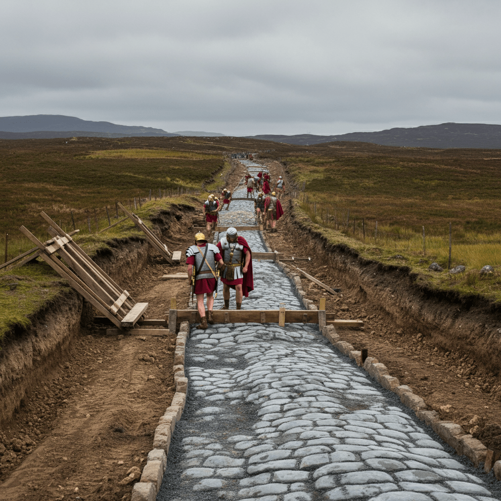
Roman roads connected the forts, camps, ports and frontiers of Roman Scotland.
They allowed soldiers, supplies, animals and messages to move through a landscape that Rome attempted to conquer and control several times between the late first and early fourth centuries AD.
Some routes can still be followed today. Others survive only as low earthworks, cropmarks, buried archaeology or short stretches discovered during excavation.
Explore the Roman Road Network
The Roman road system makes much more sense when seen on a map.
The interactive map shows known and probable Roman roads alongside forts and other military sites across Scotland.
Oopen the roman Roads Interactive Map
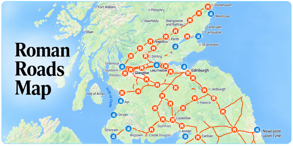
Roman road mapping is not always certain. Some stretches have been excavated and securely identified; elsewhere archaeologists reconstruct routes from surviving earthworks, aerial photography, LiDAR, old maps and the position of Roman forts.
The map should therefore be seen as a guide to the archaeological evidence rather than a claim that every Roman road can be precisely traced.
You can also explore the wider collection of maps on the website:
Why the Roads Mattered
The Roman army depended upon communications.
A fort was not an isolated military base. It had to receive food, equipment, replacement soldiers, horses and messages and remain connected with other forts and supply centres.
Roads therefore became part of a much larger military landscape:
forts → camps → roads → bridges → ports → rivers → frontiers
They also help explain why Roman sites occur where they do.
To see the wider military network, explore:
The Main Roman Routes
Dere Street — the Main Road into Eastern Scotland
Dere Street was one of the most important Roman roads leading into Scotland.
It crossed Hadrian’s Wall at Corbridge before running north towards the Tweed and the major Roman complex at Trimontium, Newstead.
From there the route continued north by the Leader Water towards the Lothians, Musselburgh and ultimately Cramond on the Firth of Forth.
A particularly well-preserved stretch survives near Soutra in the Scottish Borders.
A Roman milestone found near Ingliston also demonstrates that the road continued to be used during the Antonine occupation of Scotland.
Explore Dere Street
A Westerly Extension to Dere Street at Newbridge, Edinburgh
Archaeological work at Newbridge revealed a substantial Roman road whose construction resembles roads discovered at Cramond and Inveresk but unusually included kerbstones.
Read: A Westerly Extension to Dere Street at Newbridge
Trimontium: A Key Node in the Roman Occupation of Scotland
Trimontium occupied a strategically important position in the road network of southern Scotland.
Dr John Reid explains the Roman complex at Newstead and its importance to the occupation of Scotland.
Watch/Read: Trimontium — A Key Node in Roman Scotland
Watch: Walking Britain’s Roman Roads — Dere Street
The Gask Ridge — Road, Forts and Watchtowers
North of the Forth lies one of Britain’s most remarkable Roman military landscapes.
A Roman road ran through the Gask Ridge system, connecting forts and a chain of small watchtowers between the Ardoch area and the Tay.
The Gask system is important because the road, forts and watchtowers together reveal how the Roman army attempted to control movement through the landscape.
Parts of the route can still be explored on foot or by bicycle.
Explore the Roman Gask Project
The wider development of the Roman occupation under Agricola, including forts and roads north towards the Tay, can also be explored here:
Agricola’s Invasion of Scotland — AD 79
Romans in Scotland in Maps Through the Years
Castledykes, Lyne and the Roads of Southern Scotland
Roman roads also crossed the Southern Uplands and linked the major military centres of southern Scotland.
The road east of Castledykes Roman Fort is particularly interesting because excavation found evidence for more than one phase of road construction.
Further east, Lyne Roman Fort near Peebles stood within the network of routes linking the Clyde valley with Trimontium and eastern Scotland.
These sites remind us that Scotland did not have one single Roman highway. It had an interconnected military network which changed as Roman strategy changed.
Explore
Research: The Roman Road East of Castledykes, Lanarkshire
Nine Mile Burn
A surviving stretch of Roman road can also be seen at Nine Mile Burn, south of Edinburgh.
The Stanegate — Gateway to Roman Scotland
The Stanegate lies south of modern Scotland but is essential to understanding the northern campaigns.
It connected Carlisle and Corbridge through the Tyne–Solway corridor and linked important Roman forts including Vindolanda.
Before the construction of Hadrian’s Wall, forts along the Stanegate formed an important military line.
It remained one of the principal routes by which troops and supplies could move towards Scotland.
The changing relationship between the Stanegate, Hadrian’s Wall and Roman Scotland can also be followed through the site’s chronological maps:
Romans in Scotland in Maps Through the Years
The Antonine Wall Military Way
When the Antonine Wall was constructed across central Scotland in the AD 140s, another major Roman road became part of the frontier.
The Military Way ran behind the Wall and connected its forts.
Sections of this road survive archaeologically, including a particularly clear stretch near Seabegs Wood.
This was not simply a path beside the frontier. It formed part of the infrastructure that enabled soldiers stationed along the Wall to communicate and receive supplies.
You can also explore the inscriptions left by the soldiers who constructed the frontier:
How Roman Roads Were Built
Roman roads in Scotland were not normally paved with large stone slabs like the famous image many people have of Roman roads in Italy.
Construction varied according to terrain and the materials available locally.
A military road could include:
- a raised road mound or agger
- foundations of larger stones
- layers of compacted gravel
- a cambered running surface
- drainage ditches
- kerbstones
- culverts
Roman engineers favoured direct routes where practical, but roads could change direction to negotiate hills, rivers, boggy ground and suitable crossing points.
The surviving archaeology at places such as Dere Street, Castledykes and Newbridge shows that Roman road construction in Scotland was not uniform.
Roads could also be repaired, altered or completely rebuilt during later periods of Roman occupation.
Roman Roads You Can Still See
Although much of the Roman road system has disappeared beneath later roads, fields and towns, there are places where traces can still be seen in the Scottish landscape.
Dere Street near Soutra
One of the best places in Scotland to appreciate the line of a Roman road.
The Gask Ridge
The road can be explored alongside the wider landscape of forts and watchtowers.
Explore the Roman Gask Project
Seabegs Wood
A good location for seeing the Military Way associated with the Antonine Wall.
Nine Mile Burn
Another surviving Roman road landscape south of Edinburgh.
See the Roman Road at Nine Mile Burn
Maps & Interactive Resources
Roman Roads Interactive Map
The main Roman roads in Scotland map brings together Roman road alignments and military sites across Scotland.
Open the Interactive Roman Roads Map
Romans in Scotland Map Index
Explore the growing collection of maps covering forts, camps, roads, frontiers, coin finds and different periods of the Roman occupation.
Explore all Romans in Scotland Maps
Romans in Scotland Through the Years
See how the military occupation, forts and roads changed from Agricola’s invasion through Hadrian and Antoninus Pius.
Romans in Scotland in Maps Through the Years
Roman Street Map
An alternative interactive resource for exploring the Roman road system.
Digital Atlas of Roman and Medieval Civilisations
The Digital Atlas provides another way of exploring archaeological evidence through map layers.
Digital Atlas of Roman and Medieval Civilisations
The Peutinger Table — Rome’s Ancient Road Map
The surviving medieval copy of the Tabula Peutingeriana, or Peutinger Table, provides a fascinating glimpse of how routes and connections across the Roman Empire could be represented.
It looks very different from a modern geographical map.
Routes, towns and stopping places mattered more than accurately reproducing the shape of countries and coastlines.
Explore the Peutinger Table — Ancient Roman Road Map
Discoveries & Research
Roman roads continue to be discovered and reinterpreted.
Modern research uses excavation alongside aerial photography, geophysics, historic mapping and LiDAR to identify roads which may be almost invisible at ground level.
Dere Street at Newbridge
Evidence of an important Roman road west of Edinburgh, including unusual kerbstones.
The Roman Road East of Castledykes
Excavation revealed different phases of road construction and provides an unusually detailed look at a Roman road in Scotland.
Trimontium and the Road Network
Trimontium occupied a strategically important position within the road network of southern Scotland.
Trimontium — A Key Node in Roman Scotland
Roman Road Resources Scotland
A collection of further resources relating specifically to Roman roads in Scotland.
Roman Roads Research Association
The Roman Roads Research Association brings together research into Britain’s Roman road network.
Its work is particularly useful because the exact routes of many Roman roads are still disputed and new discoveries continue to alter our understanding of the network.
Romans in Scotland also has material introducing some of the Association’s work:
Roman Roads Research Association — Video Resources
Videos & Further Resources
Walking Britain’s Roman Roads — Dere Street
Follow one of Britain’s great Roman routes through the modern landscape.
Trimontium — A Key Node in Roman Scotland
Dr John Reid discusses the importance of Newstead and its place within the Roman road network.
Roman Roads Research Association
Watch talks and research presentations dealing with Britain’s Roman roads.
Roman Roads Research Association Videos
Explore the Roman Military Landscape
Roman roads make most sense when explored alongside the forts, camps and frontiers they connected.
Roman Forts
Discover the permanent military bases connected by the road network.
Explore Roman Forts in Scotland
Roman Camps
Temporary camps help reveal where campaigning armies travelled and stopped.
The Gask Ridge
Explore the combination of road, forts and watchtowers north of the Forth.
The Antonine Wall
Follow Rome’s northern frontier and its Military Way from the Forth to the Clyde.
Roman Scotland Through Maps
See how the Roman military presence changed through successive campaigns and periods of occupation.
Explore Roman Scotland Through the Years
All Maps
Explore the complete Romans in Scotland map collection.
Find Romans Near You
Roman roads are only one part of a much larger archaeological landscape.
Use the maps and guides on Romans in Scotland to discover Roman roads, forts, camps, frontier remains, museums and discoveries across Scotland.

