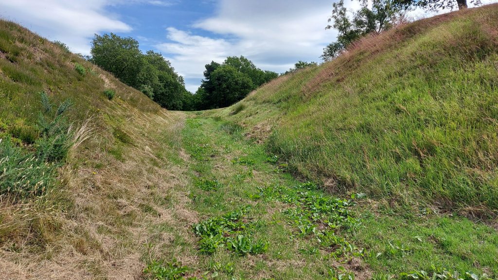
The Antonine Wall was built of turf on the orders of Antoninus Pius. This was intended to secure southern Scotland and make it part of the Roman Empire.
Teaching this topic? Explore Life on the Antonine Wall for CfE Second Level (P5–P7), with activities and an editable teacher pack.
Key Facts
37
Miles long
From the Firth of Forth to the Firth of Clyde
17
Forts
as well as around 19 fortlets
8
Countries involved
Troops from France, Spain, Germany, Bulgaria, Belgium, Syria, and the Netherlands.
6,000
Troops
Guarding the wall
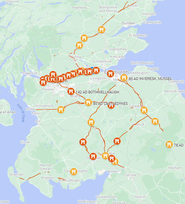
The Governor of Britain at this time, Quintus Lollius Urbicus (c. 138 – c. 144), advanced into Scotland, building new forts along the wall and reoccupying forts abandoned by Agricola (coloured in orange on the map. Many nations took part in the invasion as auxiliary troops to the Roman legions. It is estimated that 5,000 troops were stationed on the Antonine Wall, less than the 7,000 for Hadrian’s Wall. German, French, Spanish, Bulgarian, Dutch and Belgian troops were part of the occupation force. The Roman policy demanded a tribute of fighting men from conquered tribes and sent these troops to other countries. Slave girls were also taken as well as hostages. Conquered Scottish tribes would have had to provide fighting men who then served on the Rhine. See Romano-British Troops Across the Roman Empire.
A few of these auxiliary units were moved from Hadrian’s Wall, which was then put on a care-and-maintenance basis. The map below shows new forts in red and refurbished forts from Agricola’s time in 80 AD in orange.
The legions that built the Antonine Wall
- Legio II Augusta — RIB 2139 (Bridgeness); RIB 2203, 2204 (Duntocher sector); RIB 2191, 2192 (Balmuildy). Roman Inscriptions of Britain+4Roman Inscriptions of Britain+4Roman Inscriptions of Britain+4
- Legio VI Victrix (Pia Fidelis) — RIB 2196 (Castlehill); RIB 2185 (Kirkintilloch); RIB 2200 (Duntocher); RIB 2194 (Balmuildy). Roman Inscriptions of Britain+3Roman Inscriptions of Britain+3Roman Inscriptions of Britain+3
- Legio XX Valeria Victrix — Hutcheson Hill/Cleddans sector: RIB 2198 (plus nearby RIB 3507). Roman Inscriptions of Britain+1
Forts on the Antonine Wall
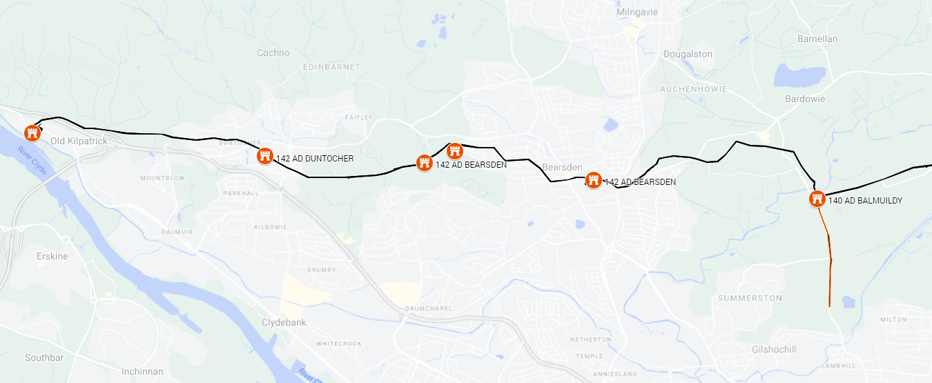
Glasgow Antonine Wall and Forts
Forts
| Fort Name | Size (Hectares) | No of Soldiers | Units | Notes |
|---|---|---|---|---|
| Old Kilpatrick | 1.66 | 585 | Batavians (Netherlands) | Cohors I Baetasiorum c.R. — altar: RIB 3509 |
| Dunochter | 1.43 | 457 | Legio II Augusta Legio VI Victrix | Legio II Augusta — distance slabs: RIB 2203, RIB 2204; Legio VI Victrix — distance slab: RIB 2200 |
| Bearsden | 1.12 | 394 | ||
| Castlehill | 1.39 | 490 | Gauls (France) Legio VI Victrix | Cohors IV Gallorum — altar: RIB 2195. Legio VI Victrix — distance slab: RIB 2196 |
| Balmuildy | 1.76 | 621 | II Augusta VI Victrix | II Augusta — honorifics RIB 2191, RIB 2192; VI Victrix — distance slab RIB 2194 |
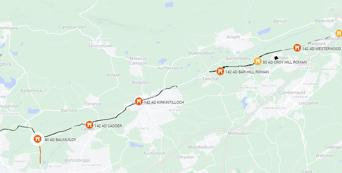
Central Scotland Antonine Wall and Forts
Forts
| Fort Name | Size (Hectares) | No of Soldiers | Units | Notes |
|---|---|---|---|---|
| Cadder | 1.36 | 478 | ||
| Kirkintilloch | unknown | VI Victrix | VI Victrix — distance slab: RIB 2185 | |
| Auchendavy | 1.12 | 394 | Legio II Augusta | series of altars by M. Cocceius Firmus, centurion of II Augusta — RIB 2174, 2175, 2176 |
| Bar Hill | 1.28 | 450 | Hamian Archers (Syria) Batavians (Netherlands) | |
| Croy | 0.61 | 214 | VI Victrix detachment | (VI Victrix detachment) — altars/building stones: RIB 2159, 2160, 2161, 2162 |
Falkirk and East of Scotland Antonine Wall and Forts
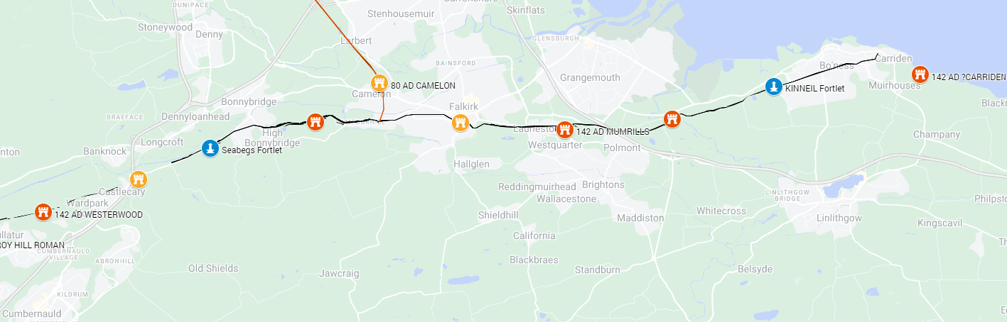
Forts
| Fort Name | Size (Hectares) | No of Soldiers | Units | Notes |
|---|---|---|---|---|
| Westerwood | 1.91 | 272 | VI Victrix | altar by Vibia Pacata, wife of a VI Victrix centurion — RIB 3504 |
| Castlecary | 2.58 | 515 | Tungrians (Belgium) Vardullians (Spain) | Cohors I Tungrorum (milliaria) — dedication: RIB 2155 Cohors I Vardullorum milliaria equitata — altar to Neptune: RIB 2149 |
| Rough Castle | unknown | 200 | Nervians (Belgium) | Cohors VI Nerviorum — altar to Victory & principia record: RIB 2144, RIB 2145 |
| Falkirk | 1.37 | 195 | ||
| Mumrills | 2.10 | 739 | Tungrians (Belgium) Thracians (Bulgaria) | Ala I Tungrorum — altar: RIB 2140 Cohors II Thracum: RIB 2142 |
| Carriden | unknown | unknown | II Augusta | Bridgeness distance slab of II Augusta (just WNW of Carriden): RIB 2139 |
The forts were abandoned from 158 AD to 165 AD as the Romans withdrew to Hadrian’s Wall due to pressures elsewhere in the empire. The forts were carefully dismantled and ditches filled in.
Timeline
AD 139–142: Decision to advance north from Hadrian’s Wall.
AD 142–c. 146: Main build under Antoninus Pius by the three legions; turf rampart on a monumental ditch (the ‘Antonine Ditch’) with stone bases and forts every ~2 Roman miles.
c. 142–c. 160/162: Primary occupation. Fort/vicus life in full swing; altars, distance slabs, bathhouses, granaries, industrial activity.
c. 160/162: Strategic withdrawal to Hadrian’s Wall; many Antonine sites deliberately decommissioned.
Later 2nd–early 3rd c.: Intermittent re-use/repairs in places (Severan campaigning, AD 208–211), but the Wall is not fully re-garrisoned like before.
Post-Roman afterlife: Stones re-used, earthworks persist; modern excavation, aerial survey, and LiDAR have fixed the line, fortlets, and Military Way with high confidence.
What to expect at key forts (quick highlights)
Bearsden: Bath-house/latrine (excellent for education—diet, health, daily life); vicus and drainage studies.
Rough Castle: Best place to show visitors the lilia and ditch profile.
Castlecary & Mumrills: Size and epigraphy (unit stones, industrial remains, cemeteries).
Bar Hill: Command views and principia plan; classic hill-fort on the line.
Watling Lodge ditch: The showpiece for the ditch/rampart cross-section.
Old Kilpatrick & Carriden: The sea-terminals—story of supply by river/estuary.
References
- The Antonine Wall – Official Government Site
- Were There Two Antonine Occupations of Scotland? N. Hodgson, Britannia, Vol. 26 (1995), pp. 29-49 (21 pages)
- THE ANTONINE WALL Frontiers of the Roman Empire: The Antonine Wall – A World Heritage Site: 2021, pp. 39-75 (38 pages)
- Julius Verus and the Abandonment of Antonine Scotland – Britannia, Vol. 51 (2020), pp. 323-330 (8 pages)


Leave a Reply