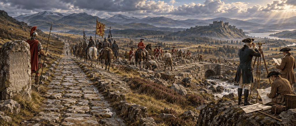
The Roman armies eventually disappeared from Scotland, but the landscape they created did not. Roman roads continued to carry travellers and armies, their forts became landmarks for medieval communities, their emperors provided prestigious names for Scottish kings, and their remains fascinated map-makers, soldiers and scholars for centuries.
Rome never completely conquered what is now Scotland. Its occupation was intermittent and overwhelmingly military, and there was no network of Roman towns comparable with southern Britain. Yet the relationship between Rome and northern Britain lasted for more than three centuries, and its influence continued long after the last Roman soldiers had gone. (Scarf Scot)
Perhaps the most remarkable part of the Roman story in Scotland is therefore what happened after Rome.
The roads survived the Empire
Roman roads were constructed to move armies, supplies and information quickly through conquered territory. When the Roman army withdrew, those roads did not suddenly disappear.
A road was still a road.
The route running north from the Borders towards the Forth, usually known as Dere Street, was constructed during the Roman campaigns of the late first century AD. Even after Roman rule ended, it remained an important line of communication through southern Scotland. Historic Environment Scotland records that in 1298 Edward I of England marched his army north along Dere Street on his way to defeat William Wallace’s army at the Battle of Falkirk. (Historic Environment Scotland)
More than twelve centuries after Agricola’s soldiers had first marched north, another invading army was therefore using essentially the same route.
The Roman road to Bannockburn
There is an equally striking example from 1314.
This time the English king was Edward II, not Edward I. His army was marching towards Stirling Castle when it encountered Robert the Bruce’s forces at Bannockburn.
The National Trust for Scotland identifies the Roman road running between the Roman sites around Falkirk and the crossing of the Forth at Stirling as the most direct route available to Edward’s army. Much of the surrounding landscape consisted of difficult boggy, wooded or hilly ground. The ancient Roman route therefore still helped determine how an army moved through central Scotland more than 1,200 years after it had been constructed. (National Trust for Scotland)
This is an extraordinary piece of continuity: Roman military geography helped shape one of the defining battles of medieval Scotland.
And the survival of Roman roads was not confined to famous battles. Excavation of the Roman road at Cramond, near Edinburgh, recovered medieval and post-medieval material from its surface. The excavators concluded that the road may have remained in use into the 17th or even 18th century.
Elsewhere, the Roman road running north from Camelon through Stirling towards Ardoch, Strageath and the Tay remained such a useful route that significant sections continued in use in later periods. (Scarf Scot)
Roman places became medieval places
The Antonine Wall also remained part of Scotland’s landscape.
People living beside it did not necessarily understand precisely who had constructed it, but its huge ditch, banks, roads and abandoned forts remained obvious features.
A particularly interesting discovery was made at Callendar Park in Falkirk, where a large ninth-century timber hall was built just north of the former Roman Military Way. It has been interpreted as a residence associated with the Thanes of Callendar.
Medieval castles or mottes were also established at or close to Roman sites including Inveravon, Watling Lodge, Seabegs, Kirkintilloch and Cadder. At some locations the builders could take advantage of existing earthworks and naturally strategic positions. Archaeologists rightly caution that this does not prove medieval lords were deliberately trying to inherit Roman authority: sometimes the Romans and medieval builders simply recognised the same good defensive locations. (Scarf Scot)
But the Roman landscape had certainly not disappeared.
Indeed, the Antonine Wall was important enough to appear on a map of Britain drawn by the English monk Matthew Paris around 1250, centuries before anything resembling modern archaeology existed. Later research traces an almost continuous sequence of attempts to understand and map the monument. (Taylor & Francis Online)
Constantine: a Roman emperor’s name becomes a royal name
There is a rather different Roman survival in the names of Scotland’s early rulers.
The emperor Constantine the Great was one of the most famous figures of the later Roman world. He was proclaimed emperor at York in AD 306 after the death of his father, Constantius, following their campaigning against the Picts.
Several centuries later, the name appears among the rulers of Pictland and Alba. Roman political rule had vanished, but the prestige of Christian Rome survived strongly enough for Constantinus to become a name associated with the kings of Pictland and Alba.
Causantín mac Fergusa, who died in 820, ruled the Picts and is recorded in sources as Constantine. The name subsequently recurred among the royal dynasties which ruled Pictland and the emerging kingdom of Alba. (dib.ie)
The Gaelic/Pictish Causantín represents Latin Constantinus.
There is an intriguing argument that choosing such an unusual royal name deliberately evoked Constantine the Great — the Christian Roman emperor. Recent research on the Dupplin Cross notes that the name was a significant departure from the usual Celtic/Pictish royal names and argues that it could carry associations with Constantine and the Christian Roman past. However, whether every later king bearing the name was consciously claiming Roman imperial inheritance cannot be proved. (theses.gla.ac.uk)
General Wade — Rome’s roads reinvented?
More than a millennium later Scotland again saw soldiers building strategic roads through difficult country.
Following the Jacobite rising of 1715, General George Wade was sent to examine the Highlands. From 1725 he oversaw an enormous programme of roads, bridges and military infrastructure intended to allow government troops to move rapidly through the region.
Between 1725 and 1737 Wade oversaw approximately 250 miles of roads and 40 bridges, linking places including Perth, Inverness, Fort William and Fort Augustus. Historic Environment Scotland describes these roads as forming the first planned post-Roman road system in Britain. (Historic Environment Scotland Blog)
It would be going too far to claim that Wade simply copied Roman roads. He did not.
But the similarity was obvious to educated contemporaries: once again a central government was using forts, roads and military engineering to penetrate and control difficult territory.
One Scottish antiquary made the comparison explicitly.
Sir John Clerk: “the Romans” and the Highlands
Sir John Clerk of Penicuik was fascinated by Roman Scotland. He collected Roman inscriptions and sculptures and became one of the leading authorities on the Antonine Wall.
By 1740, Clerk had become almost a clearing-house for news of Roman discoveries. Scholars sent him reports of newly discovered inscriptions and consulted him on Roman terminology and the structure of the Wall.
But Clerk did more than study the Romans.
After the Jacobite rising of 1745, he compared the British government’s military operations in the Highlands with the Roman conquest of Caledonia. During a journey through the western Highlands in 1748, he even composed a Latin-style inscription praising British military engineering and the new roads.
To Clerk, the Hanoverian army was in some respects playing the part once played by Rome: military force followed by roads, communications and what he regarded as “civilisation”.
Whatever we think of that political viewpoint today, it demonstrates the extraordinary power that the idea of Rome still possessed.
Rediscovering Roman Scotland
By the sixteenth and seventeenth centuries, scholars were increasingly trying to identify exactly what the Romans had left behind.
In the later 1500s, Timothy Pont examined the Antonine Wall and recorded several of its forts.
In 1707 Sir Robert Sibbald published a map and description of Roman remains in Scotland.
During the eighteenth century, William Stukeley, Alexander Gordon and John Horsley produced increasingly detailed maps, descriptions and records of inscriptions. The history of this work is itself now an important area of study. (Taylor & Francis Online)
Then came one of the most important figures in the history of Roman archaeology in Scotland.
General William Roy — soldier and archaeologist
General William Roy should not be confused with General Wade.
Roy was a young military surveyor involved in the great mapping of Scotland undertaken after the Jacobite rising of 1745. His experience as a soldier and surveyor gave him an unusually good understanding of terrain, roads and fortifications.
He applied those skills to Roman remains.
Roy surveyed the Antonine Wall, Roman forts and other military sites in remarkable detail. Modern researchers note that the accuracy of his work was not surpassed for about a century. His research was eventually published in 1793 as The Military Antiquities of the Romans in North Britain.
There is a pleasing symmetry here.
A British military engineer sent to survey Scotland after a rebellion became one of the people who best understood the military engineers Rome had sent to Scotland nearly 1,700 years earlier.
From antiquarians to archaeologists
Interest gradually became more systematic.
The Society of Antiquaries of Scotland began assembling collections in the eighteenth century. Glasgow University’s Roman collections eventually formed an important part of the Hunterian Museum, while archaeological societies organised investigations of the Antonine Wall and its forts.
By the nineteenth and twentieth centuries, excavation replaced much of the speculation of earlier antiquaries.
That tradition continues today using techniques which Roy, Clerk and Sibbald could never have imagined: aerial photography, geophysics, LiDAR, soil analysis and digital mapping. The modern research into the Antonine Wall explicitly builds upon the maps and observations made by those earlier generations.
Romans in Scottish literature
Roman Scotland also entered popular culture.
Sir Walter Scott famously mocked over-enthusiastic Roman antiquarians in his novel The Antiquary. His fictional Jonathan Oldbuck triumphantly interprets a supposedly Roman inscription as evidence for Agricola — only to discover that the feature has a much more recent and considerably less glorious explanation.
Scott’s joke was partly based on a real incident involving Sir John Clerk, who once mistook a comparatively recent sheepfold for a Roman camp.
The Romans had become sufficiently embedded in Scottish culture that even getting them wrong could be funny.
Roman soldiers in the First World War
Perhaps the strangest survival came during the First World War.
Members of a Scottish Royal Engineers unit deliberately produced mock Roman inscriptions commemorating their own construction work. Their inspiration included the great Antonine Wall distance slabs, carved by Roman legionaries almost eighteen centuries earlier.
The engineers cast themselves as the modern descendants of Roman military builders — soldiers constructing roads and installations while campaigning among “barbarians”.
It is difficult to find a better demonstration of Rome’s cultural afterlife.
Roman soldiers had left Scotland centuries earlier, yet British soldiers were still comparing themselves with them in the twentieth century.
From abandoned frontier to World Heritage Site
The final transformation has been from military frontier to protected heritage.
In 2008, the Antonine Wall became part of UNESCO’s Frontiers of the Roman Empire World Heritage Site. Roman roads, forts, inscriptions and sculptures which were once quarried, built over or simply misunderstood are now surveyed, conserved and studied internationally. (Historic Environment Scotland)
Today the Antonine Wall links Scotland not only with Rome but with surviving Roman frontiers across Europe.
The frontier which was built to divide people has become something that connects them.
So what did the Romans really leave Scotland?
Rome did not leave Scotland a Roman-speaking population, great Roman cities or a continuous Roman administration.
Its longer-term legacy was subtler.
The Romans altered the landscape. Their roads remained useful long after the legions had vanished.
They created strategic places. Medieval communities, lords and armies continued to use the same routes and sometimes the same locations.
Rome remained prestigious. Even the imperial name Constantinus entered the world of early Scottish kingship.
The Romans became a model. Eighteenth-century soldiers and intellectuals compared contemporary Scotland with ancient Caledonia.
And finally, Roman Scotland became something to investigate. From Matthew Paris and Timothy Pont to Sir John Clerk, William Roy and modern archaeologists using LiDAR and geophysical survey, people have spent centuries rediscovering the traces Rome left behind.
The Roman occupation of Scotland was relatively short.
Its afterlife has lasted for more than 1,500 years.
Sources and further reading
The Antiquarian Rediscovery of the Antonine Wall (Lawrence Keppie,2012)
The Antonine Wall Papers in Honour of Professor Lawrence Keppie (edited by David J. Breeze and William S. Hanson) Apr 2020
See https://symbolstones.archaeoptics.co.uk/ Class 1 sites are from 350 AD. You can sort Pictish symbols by image to see the spread of ideas.

