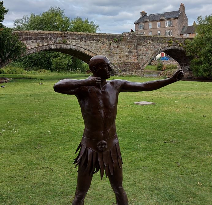
On the high ground at Inveresk, above Musselburgh and the River Esk, stood a Roman fort with a civilian settlement beside it. The site is chiefly associated with the Antonine occupation of Scotland in the mid-second century AD. Its remains lie largely beneath the modern village, but excavations and chance discoveries have revealed a military community with buildings, baths and places of worship
Visit Inveresk Roman Fort
📍 Location: Inveresk, Musselburgh, East Lothian
👁 What survives: The fort lies largely beneath the modern village, but excavations and finds reveal a substantial military and civilian settlement.
⭐ Best for: Roman life near the Forth, including baths, religion, trade and the civilian settlement beside the fort.
🥾 Visit: An urban heritage visit with little of the fort visible above ground.
🏛 Nearby Roman places: Elginhaugh, Cramond and the National Museum of Scotland
Inveresk at a glance
| Occupation | Antonine period, broadly the AD 140s–160s; exact opening and closing years remain uncertain. |
| Garrison | Uncertain; structural evidence has been interpreted as indicating cavalry. |
| Size | A reliable phase-specific internal area is not established in the sources summarised here. |
| Troop estimate | No secure numerical estimate is established here; fort area alone cannot determine the number present. |
Inscriptions
Altars to Mithras and Sol and an earlier Apollo Grannus dedication illuminate religious life. Their different find contexts matter, and none supplies a complete garrison roster.
Sources for this summary
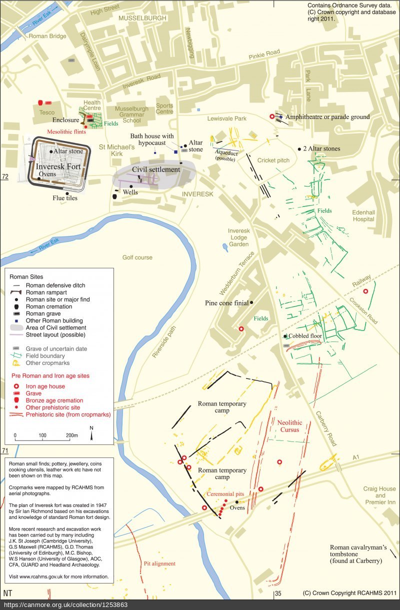
Here is an interactive map showing the fort, aqueduct, possible harbour, altar to Mithras and possible amphitheatre.
The fort
The fort stood around the site of St Michael’s Church. Excavations traced parts of its rampart and surrounding ditch, with the principal entrance facing west. There is evidence for two phases of Antonine occupation; traces interpreted as stabling suggest that cavalry may have been stationed here. The precise unit is uncertain. For a guide to the buildings and streets commonly found inside a fort, see How a Roman fort was laid out
An earlier Roman presence in Agricola’s time in the Musselburgh area has been proposed, but the evidence is not there. Likewise, the possibility of a harbour at Fisherrow supplying the army is supposition and not established by excavation. A harbour would have allowed supplies to be transported to Elginhaugh Fort. A coin from that period and burnt timbers have been found in St Michael’s Church area. Radiocarbon dating of charcoal in a marching camp oven gives a date range from 50 BC to 130 AD (see AA-49318 at https://canmore.org.uk/c14index/53837)
The vicus: life outside the ramparts
A vicus was a settlement outside a fort. At Inveresk, Roman remains extend beyond the defences, particularly towards Inveresk House and Inveresk Brae. Buildings and finds show that the site was more than a place for soldiers to sleep: people lived and worked alongside the garrison. The full extent and layout of the settlement remain uncertain because much of it is covered by later buildings and roads. Our glossary of Roman archaeology explains vicus and other terms used on this page.
Bathhouses and heated buildings
Remains in the grounds of Inveresk House include part of a Roman bathhouse: walling, furnace foundations and a hypocaust, the underfloor system used to heat rooms. These remains offer a glimpse of bathing and daily life beyond the fort’s ramparts. Read Roman Bath Houses in Scotland for an explanation of how such buildings worked.
Altars and worship
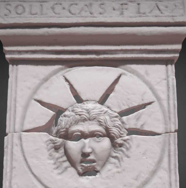
Inveresk has produced striking evidence of religious life. Two altars found in 2010 are associated with Mithras and Sol, the sun god. The altar showing Sol was designed so that light could shine through its carved face. National Museums Scotland identifies the finds with a Mithraeum, a temple to Mithras, at Inveresk. An earlier altar dedicated to Apollo Grannus has also been recorded from the area of the heated building at Inveresk House. These are separate discoveries and should not be shown as though they all stood together in one structure. Explore gods and beliefs in Roman Scotland for the wider context.
Camps and other possible structures
A temporary marching camp served an army on campaign; it was different from a fort occupied for a longer period. Evidence for Roman activity around Musselburgh should therefore be assessed site by site, rather than treating every suggested camp as an earlier phase of the Inveresk fort. See Inside a Roman marching camp to learn what archaeologists look for. Canmore
The Roman bridge (supposed)
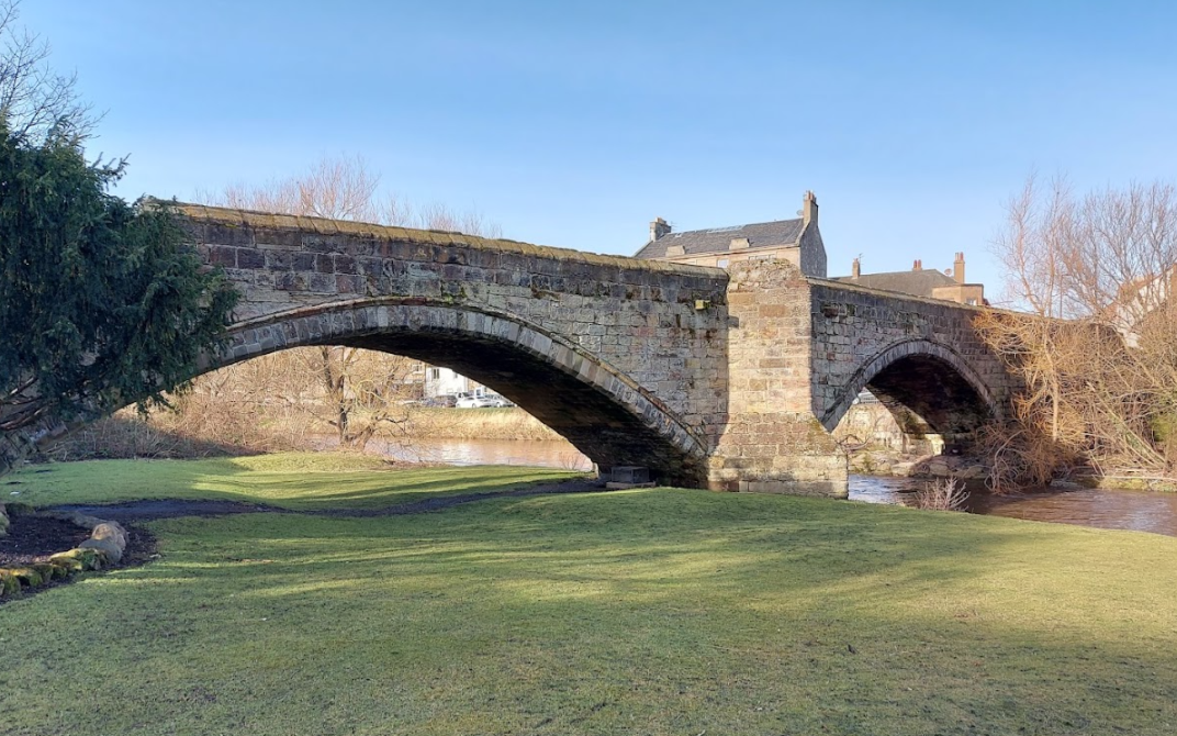
The standing bridge is a Category A-listed masonry structure dating principally to the 16th century (likely around 1597, rebuilding an earlier medieval crossing damaged during the Rough Wooing and the Battle of Pinkie in 1547). Its architectural features—such as three segmental arches with chamfered arch-rings and massive cutwaters built on timber branders—are characteristic of late medieval and early modern Scottish bridge building rather than antiquity. Local tradition says that during repairs in 1809, excavators reported finding ancient timber beams and masonry deep within the abutments. However, there is no verified archaeological evidence confirming those timbers or footings were Roman rather than early medieval.
The Roman Fisherrow harbour (supposed)
The tangible evidence in the immediate vicinity of Fisherrow consists almost entirely of stray artefactual finds and cultural deposits rather than civil engineering works:
- Artefact Scatters and HER Records: The East Lothian Historic Environment Record (HER) logs stray Roman material from around Fisherrow and the foreshore. Finds include fragments of Roman pottery (including coarsewares and samian sherds), rotary quern stones, Roman ceramic building material (tile/brick), and animal bones.
- Absence of Stone Infrastructure: Excavations and evaluations ahead of coastal and harbour developments around Fisherrow and Musselburgh have encountered 16th- to 19th-century harbour masonry, timber revetments, and post-medieval fishing settlement layers, but no Roman stonework.
- The Nature of the Present Harbour: The surviving stone harbour at Fisherrow dates to the 17th and 18th centuries (remodelled heavily in the 19th century by Robert Stevenson & Sons). It is not a rebuilt Roman structure.
The Amphitheartre (circumstancial)
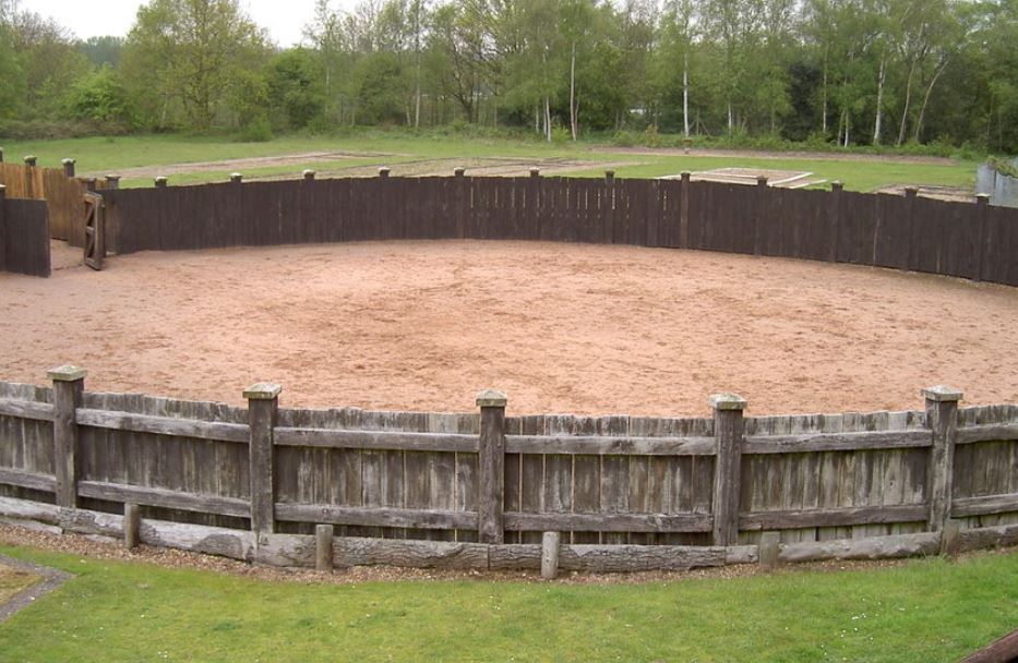
An investigation into a structure elliptical in shape and with posts showing some kind of structure has been interpreted as a possible amphitheatre in Musselburgh. The area of the structure is about 30m in diameter and would allow around 1000 people to spectate standing on raised earth ramparts or sitting in a seated structure. The presence of cavalry in Inveresk fort makes it likely that some sort of training ring could also be used for spectators and dual-use of structures was known elsewhere. Read about the possible Musselburgh Ampitheartre
Explore further
- Roman forts in Scotland
- Roman Bath Houses in Scotland
- Inside a Roman marching camp
- Glossary of Roman Archaeology
During the Antonine Wall period, in 142 AD, a stone fort was built and later refurbished. There is no evidence of occupation after 180 AD. Radiocarbon dating of oven charcoal yields dates ranging from AD 20 to 220.
References
Excavation reports
- Richmond et al. 1981 — “A Roman fort at Inveresk, Midlothian” (PSAS 110) — the fundamental publication of Richmond’s 1946–47 excavation.
- Kirby et al. 2020 — “Excavations at Musselburgh Primary Health Care Centre” (SAIR 89) — particularly important: Roman burials, decapitations, horse burial, possible fortlet, field system, midden and artefacts. The page provides the full report PDF plus individual chapter PDFs.
- Bishop 2004 — Inveresk Gate: Excavations in the Roman Civil Settlement at Inveresk, 1996–2000 — key publication for the vicus/civil settlement.
Trove / NRHE records
- Trove — Inveresk Roman Fort, NRHE 53919 / NT37SW 8 — the principal archaeological record for the fort, with bibliography and numerous archive images.
- Trove — Inveresk Roman finds, NRHE 75993 / NT37SW 8.01 — Roman pottery and other finds associated with Inveresk/St Michael’s churchyard.
- Trove — Inveresk bath-house, NRHE 53776 / NT37SW 13 — includes the hypocaust/bath-house evidence and references to the Apollo Grannus altar.
- Trove — Roman camp/cropmarks south of Inveresk, NRHE 53866 / NT37SW 33 — records the substantial V-shaped Roman ditch and possible large temporary camp.
- Trove — Wedderburn House, NRHE 115375 / NT37SW 218 — particularly useful for the wider Roman landscape, field systems, archaeological interventions and archive material.
Historic Environment Scotland
- HES designation — Inveresk Roman fort and civil settlement, Scheduled Monument SM3285 — the official scheduled-monument record.
- Historic Scottish Burgh Survey — Musselburgh PDF — useful overview of Inveresk and Musselburgh archaeology, including the fort and Roman discoveries around St Michael’s churchyard.
National Museums Scotland
- Roman Scotland: Life on the Edge of Empire — National Museums Scotland — especially relevant because NMS highlights the two spectacular altars associated with Inveresk as central objects in the exhibition.

