Dumfries stands near the River Nith, another of the great natural corridors leading from the Solway into inland Scotland. Roman forts and camps around the region show how armies used and protected this route.
Discover the Roman stories nearby
Dalswinton: changing plans beside the Nith
Survey has revised older interpretations of the military complex. Read why a camp, a fort and an annexe need to be distinguished.
Glenlochar: another river corridor
Compare the Nith valley with the fort beside the Dee near Castle Douglas. Follow the site guide for its plan and inscribed finds.
Explore the Roman sites map
Select the local map below to open the interactive view, then zoom or select a marker. Read the evidence notes below alongside it: a marker shows a recorded location or proposal, not proof that a Roman structure survives
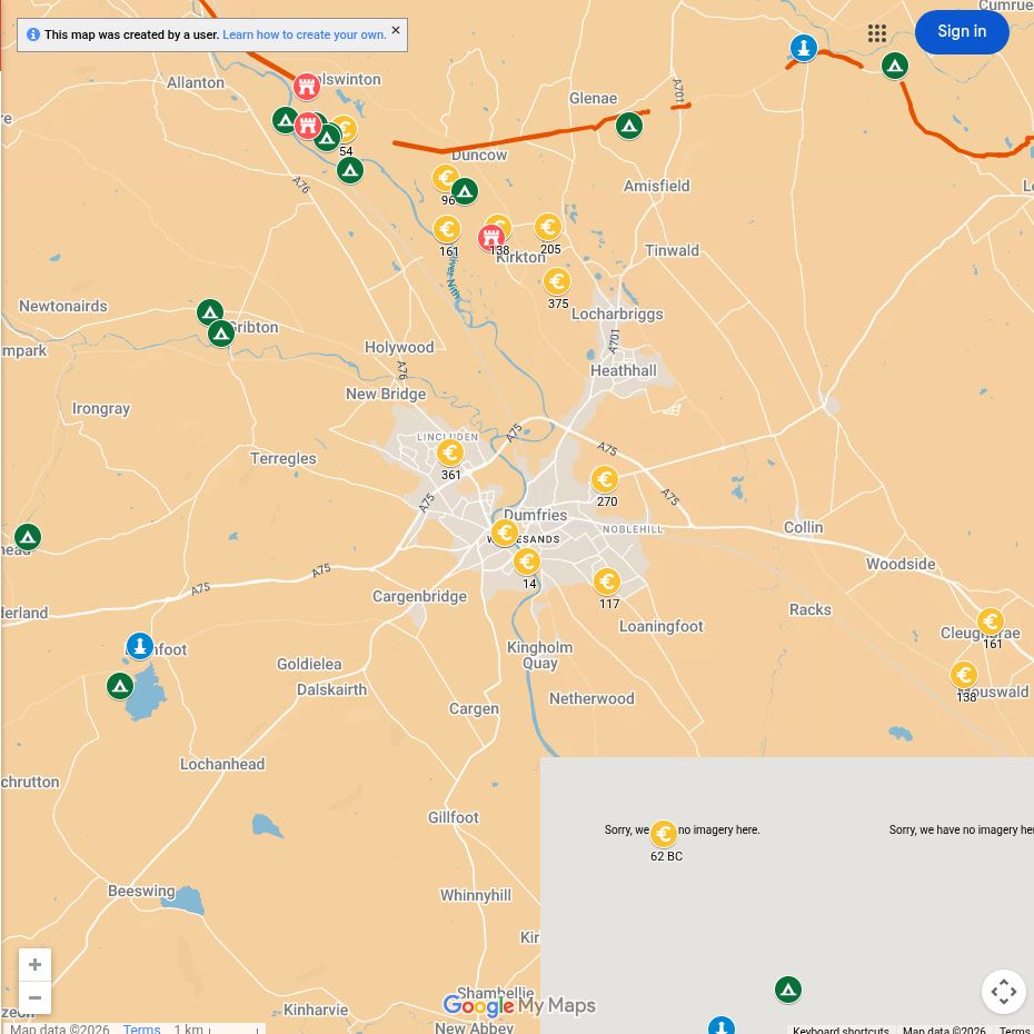
Open the interactive map full screen
What the evidence establishes
- Dalswinton — established forts and camps. Aerial, geophysical and LiDAR surveys distinguish several enclosures. A large enclosure is not automatically a permanent fortress.
- Carzield and Glenlochar — established Roman forts. Excavation and survey supply much of the evidence; the absence of visible walls does not make the identifications speculative.
- Butterhole Brae near Dalswinton — Roman interpretation rejected by the 2019 reassessment. Do not count its three enclosures as confirmed Roman military sites.
- Ward Law — a separate camp landscape. It should not be presented as part of the same fort or necessarily the same episode of occupation.
Why this area mattered
Nithsdale provided a western alternative to Annandale. From the Solway, troops could move towards Clydesdale and central Scotland while smaller routes connected with Galloway.
Plan your visit: what survives today
- Dumfries Museum: start with the regional collections, checking which Roman finds are currently displayed.
- Dalswinton and Carzield: the interest is in their relationship with the Nith, modern fields and river crossings. Most structural evidence is buried; do not expect an open excavation or standing buildings.
- Glenlochar: plan it as a separate outing near Castle Douglas, not a stop in Dumfries itself. View the wider river setting from legitimate routes and avoid entering cultivated fields.
Sources, finds and further reading
Start with the local articles above, then follow the excavation reports, archaeological records and collections below. Historical reports preserve valuable evidence but may use interpretations revised by later work.
- Hanson, Jones and Jones (2019), reassessment of the Roman military presence at Dalswinton
- Dalswinton site record
- Carzield site record and excavation references
- Glenlochar site record
- RIB 2412.80: inscribed lead from Glenlochar
Continue exploring
- Roman forts in Scotland
- Inside a Roman marching camp
- Explore Roman roads
- Dalswinton: a reassessment from aerial, geophysical and LiDAR survey — a route into the research behind the changing site plan.
- Flavia Baetica at Birrens — a woman who arranged her husband’s memorial (RIB 2115). Her name does not establish her birthplace. The stone is held by Dumfries Museum; collection holdings do not guarantee current display.
- Drumlanrig Roman Fort — follow the Nith valley farther north.

