Modern Lockerbie lies close to one of the best natural routes between Carlisle and central Scotland. The surrounding countryside contains forts, camps, roads and native strongholds that record repeated Roman activity.
Discover the Roman stories nearby
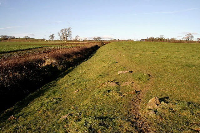
Birrens: life at an outpost
South-east of Lockerbie, successive forts and inscribed stones reveal a history of rebuilding and service on Rome’s northern routes.
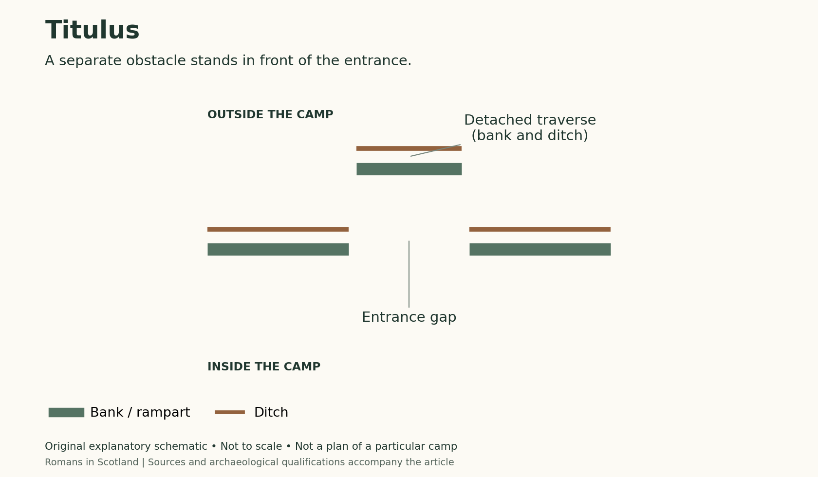
Burnswark: what do the camps tell us?
Read the hillfort, camps and missile finds together. The accompanying gateway diagram explains a camp-defence principle; it is not a plan of Burnswark.
Explore the Roman sites map
Select the local map below to open the interactive view, then zoom or select a marker. Read the evidence notes below alongside it: a marker shows a recorded location or proposal, not proof that a Roman structure survives
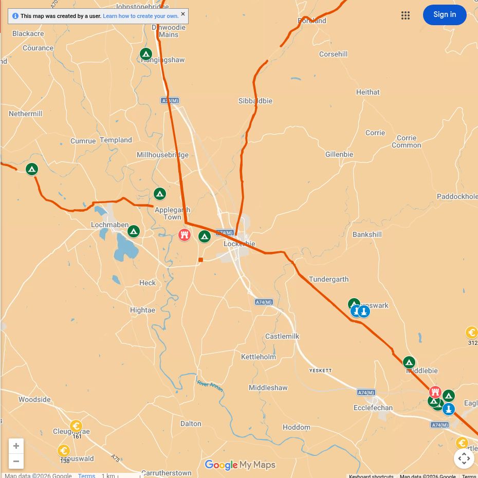
Open the interactive map full screen
What the evidence establishes
- Birrens — excavated fort and earlier military activity. Successive enclosures and buildings belong to different periods; they were not all occupied together.
- Burnswark — established earthworks and projectile finds. A Roman attack is an archaeological interpretation supported by the distribution of missiles, not an event dated by a surviving written account.
- Ladyward and the road north — separate installations. The fort near the Annan belongs within a wider route system; do not assume all the valley’s forts and camps were contemporary.
Why this area mattered
Annandale allowed armies and supplies to move north while remaining connected to the military bases around Hadrian’s Wall. Control of the valley therefore mattered during several phases of Roman advance and occupation.
Plan your visit: what survives today
- Burnswark: the most substantial outdoor Roman landscape in this guide, with grassy earthworks on steep slopes. Choose footwear for wet ground and allow for an exposed hill rather than a surfaced visitor trail.
- Birrens: a lower-level landscape visit near Middlebie. The fort platform and defences survive; the buildings themselves are buried.
- Ladyward: use the existing fort guide to understand its location. It is not an excavated ruin laid out for visitors. Annan Museum and Dumfries Museum offer indoor context; check displays and opening arrangements.
Sources, finds and further reading
Start with the local articles above, then follow the excavation reports, archaeological records and collections below. Historical reports preserve valuable evidence but may use interpretations revised by later work.
- Burnswark archaeological record
- Rebecca H. Jones (2011), Roman Camps in Scotland — Burnswark and camps in Annandale.
- Birrens excavations and site record
- RIB 2110: Birrens rebuilding inscription
Continue exploring
- Roman forts in Scotland
- Explore Roman sites
- Roman army in Scotland
- Flavia Baetica at Birrens — a woman who arranged her husband’s memorial (RIB 2115). Her name does not establish her birthplace.
- Women in Roman Scotland — read the Birrens evidence alongside the military sites of Annandale.

