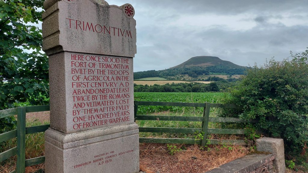
Beneath the fields beside modern Melrose lies Trimontium, the Roman complex at Newstead. Its forts, camps, roads and civilian activity made this one of the most important military centres in Roman Scotland.
Discover the Roman stories nearby
Newstead: objects from a changing fort
Shoes, tools and cavalry equipment bring the people of Trimontium into view. Follow the fort guide to explore its objects and successive plans.
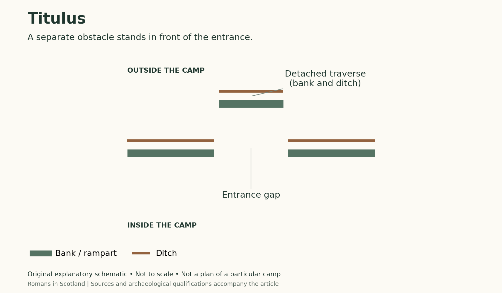
The camps around Trimontium
The surrounding enclosures belong to the wider military complex. Discover how entrances help archaeologists recognise camps without providing an exact date on their own.
Explore the Roman sites map
Select the local map below to open the interactive view, then zoom or select a marker. Read the evidence notes below alongside it: a marker shows a recorded location or proposal, not proof that a Roman structure survives
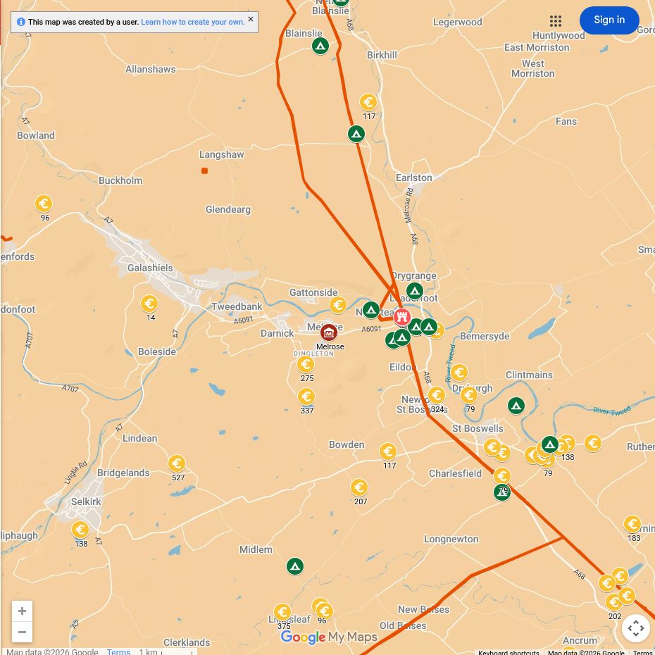
Open the interactive map full screen
What the evidence establishes
- Trimontium at Newstead — extensively excavated fort complex. The successive forts, annexes and nearby camps are distinct features and phases.
- The amphitheatre — archaeological interpretation of an excavated enclosure. Its visible outline should not be imagined as a surviving stone arena.
- Dere Street and the Tweed crossing — route evidence with local uncertainties. Modern roads and riverbanks are not a complete reconstruction of Roman alignments.
Why this area mattered
The site controlled the Tweed valley and Dere Street, the great road leading north from Roman Britain. Its position allowed troops to move towards the Forth while remaining connected to the south.
Plan your visit: what survives today
- Trimontium Museum in Melrose: begin with the finds and site interpretation. Trimontium Museum publishes current opening, booking and guided-walk information.
- Newstead: follow the signed public route and interpretation around the fort landscape. Most buildings remain below fields; the Eildon Hills and Tweed help explain the setting.
- Walking: distinguish a museum visit from the longer outdoor trip to the site. Check the museum’s current walk arrangements and allow for unsurfaced ground.
Sources, finds and further reading
Start with the local articles above, then follow the excavation reports, archaeological records and collections below. Historical reports preserve valuable evidence but may use interpretations revised by later work.
- James Curle (1911), A Roman Frontier Post and its People — digitised original excavation report
- Trimontium Museum: excavation archive
- RIB 2427.22: Senecio’s name on a saddle fitting
- Rebecca H. Jones (2011), Roman Camps in Scotland — Newstead camp catalogue.
Continue exploring
- Roman forts in Scotland
- Roman leather
- Explore Roman inscriptions
- Women in Roman Scotland — includes footwear from Newstead and the evidence for families around military bases.
- The Trimontium story — a 14-minute film from the Trimontium Trust.
- Trimontium and the Roman occupation of Scotland — John Reid’s longer lecture on the fort and its wider connections.
- Trimontium Amphitheatre — explore another part of the Newstead complex.
- Gaius Arrius Domitianus — a centurion named on altars from Newstead.

