A gap in a camp’s defences allowed soldiers, animals and supplies to pass through, but also created a point that needed protection. Roman camps used several arrangements of banks and ditches to obstruct a direct approach. Their traces can be among the most helpful clues in identifying an enclosure.
A gateway is more than an opening
Archaeologists distinguish the entrance gap from the earthworks protecting it. The number of gates and the form of their defences are separate observations. A six-gated camp need not represent a distinct function or date, and not every gate on one camp necessarily had the same protection.
| Term | Arrangement |
|---|---|
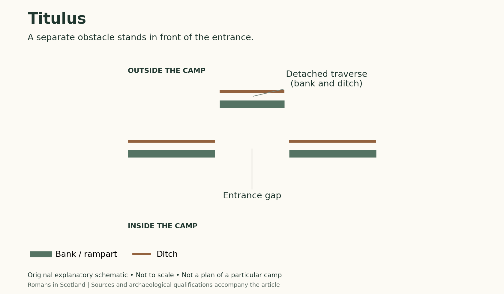
| Titulus; plural tituli | A detached traverse, normally a bank and ditch, placed outside the entrance gap. |
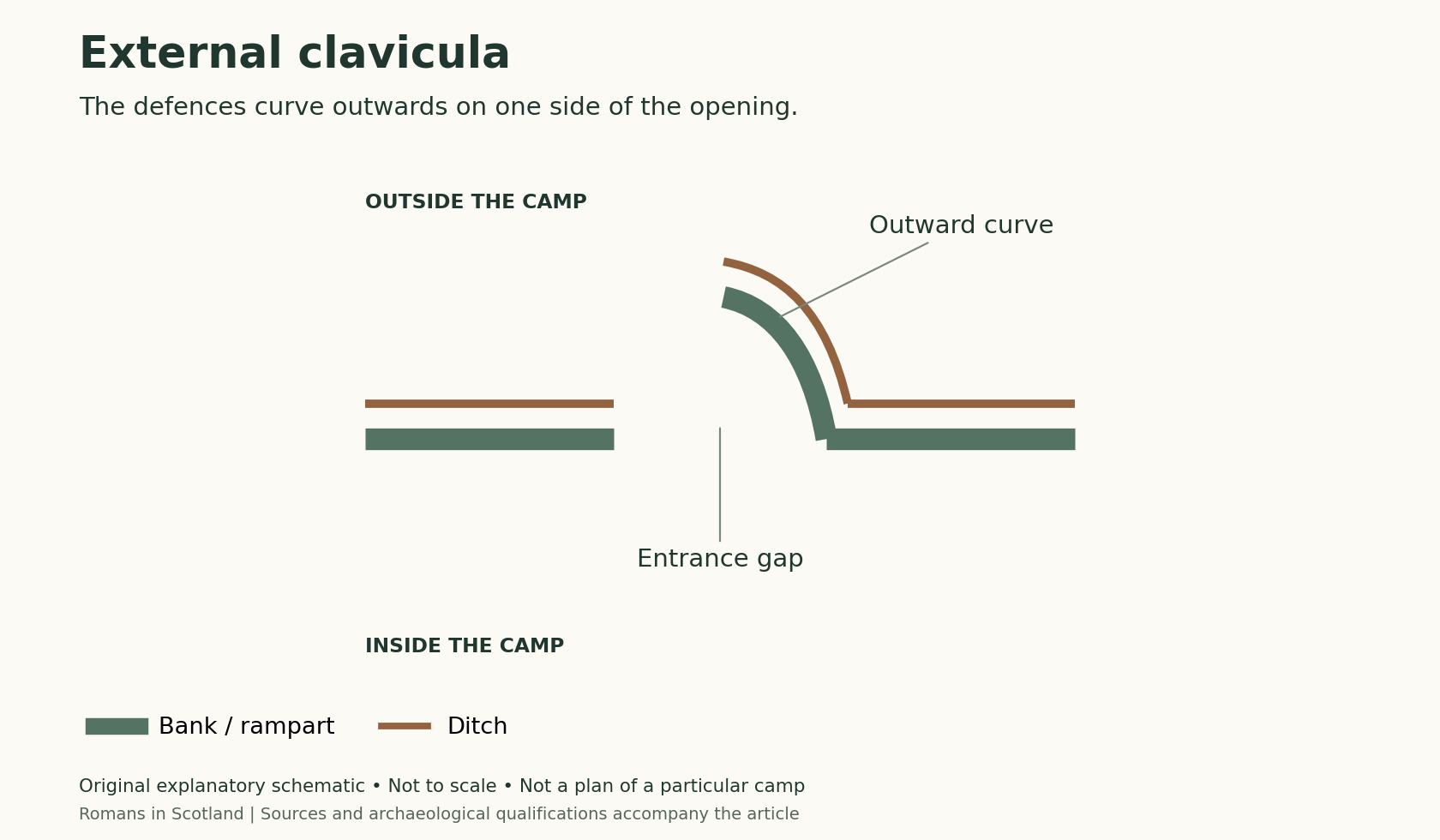
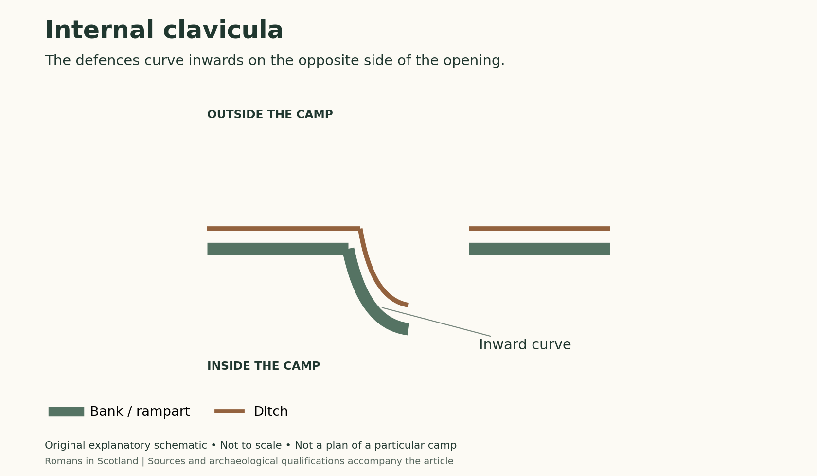
| Clavicula; plural claviculae | A curved extension of the defences controlling the approach to an entrance; it may turn inward or outward. |
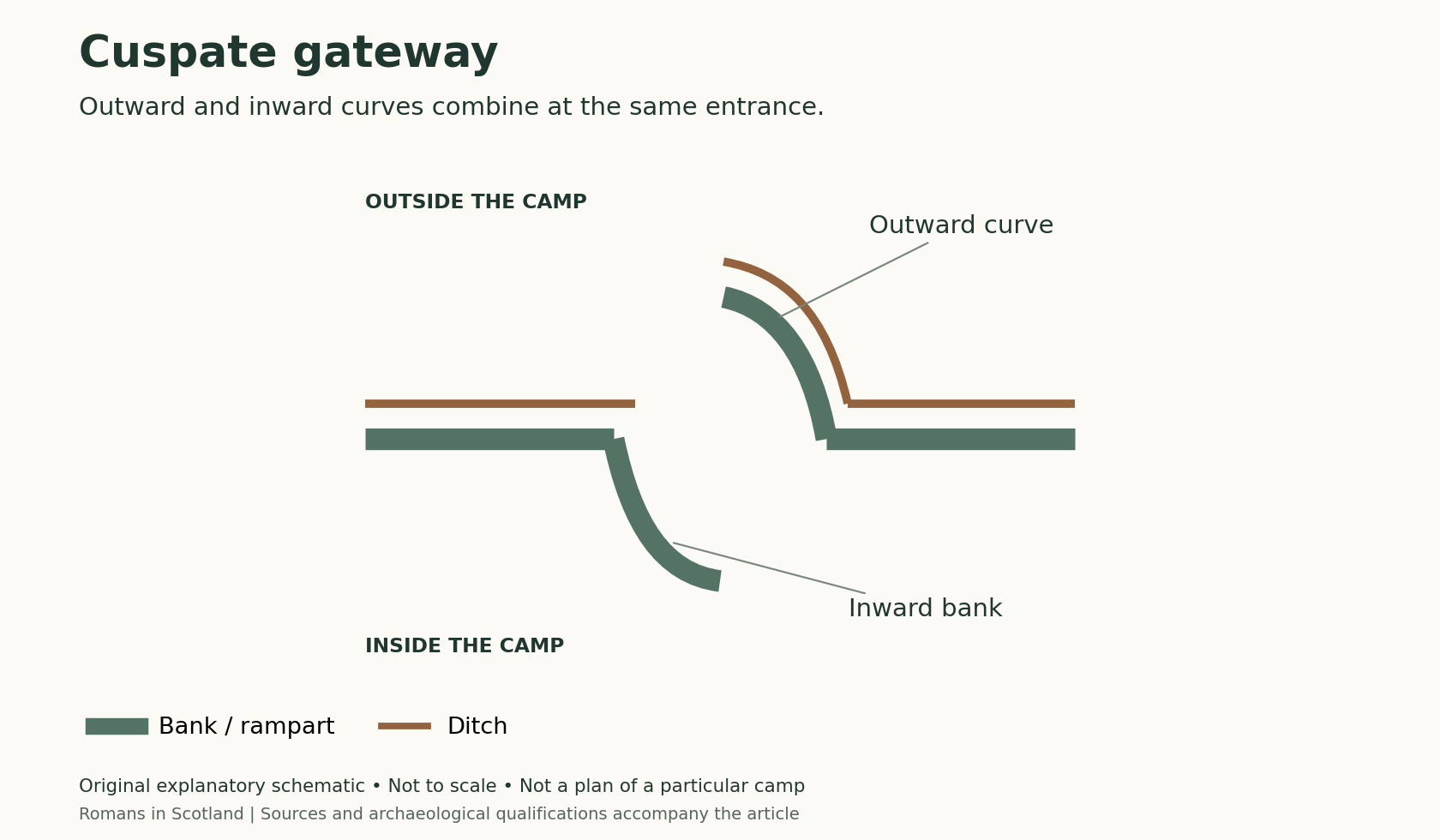
| Cuspate gateway | A combination of internal and external claviculae. |
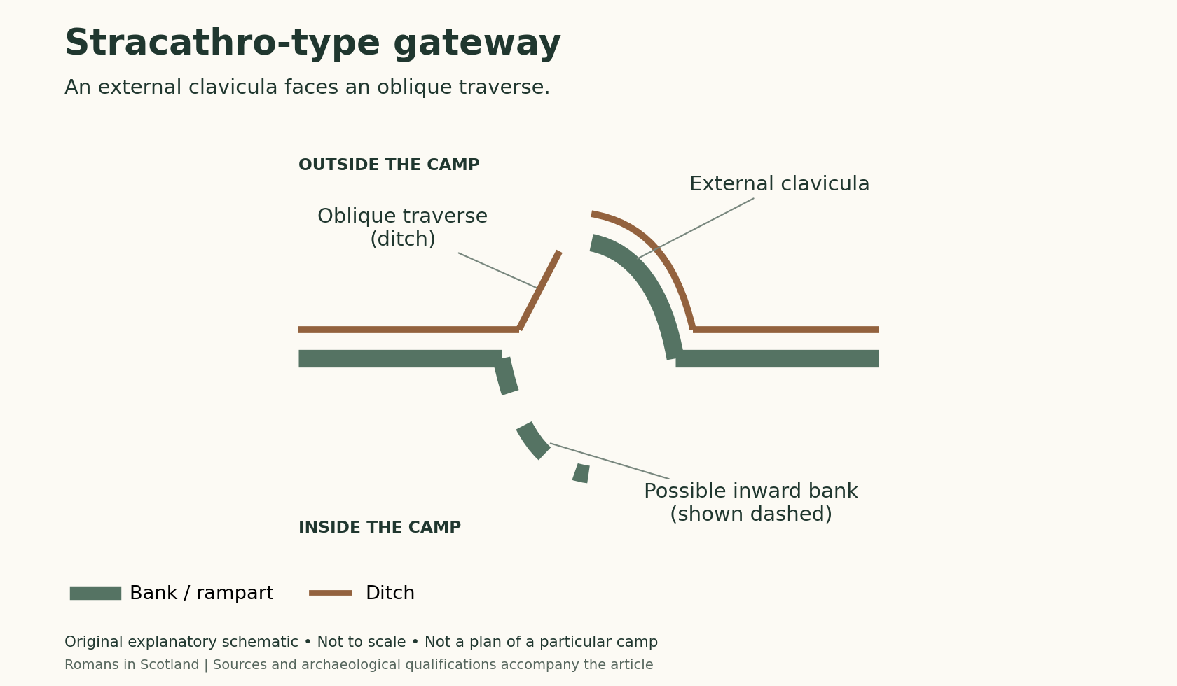
| Stracathro-type gateway | An external clavicula ditch with an oblique traverse guarding the opening; an internal curved rampart may also have existed. |
The diagrams below are original explanatory schematics, with the outside of the camp above and the interior below. Thick green lines show banks and thin brown lines show ditches. They are not to scale or plans of individual sites. Click an image to enlarge it; sources and qualifications are given at the end of the article.
Tituli
The titulus was the most commonly recorded gateway protection in Jones’s Scottish study. It interrupted the direct approach through the opening and required movement around a separate obstacle. The archaeological remains may comprise a ditch after the accompanying bank has been levelled.
There are unusual variations. At Ward Law, Jones discusses multiple tituli outside one entrance and the absence of comparable protection at another investigated entrance. Such examples warn against reconstructing every gateway from the best-preserved one.
Claviculae
A clavicula channels entry around a curved defensive line. The form is easy to understand on a complete plan, but can be difficult to recognise where ploughing has removed the bank. A rampart-only feature may leave no obvious cropmark.
Jones discusses external claviculae at Milrighall and the rarer cuspate arrangement at Oakwood. These differences are useful evidence for planning. They also illustrate how preservation affects the apparent distribution of gateway types: what can be seen is not necessarily everything that was built.
The Stracathro type
This name comes from the temporary camp at Stracathro. It should not be confused with the separate fort and its annexe. The characteristic external curve and oblique traverse make the gateway distinctive, even when recorded largely through cropmarks.
Jones notes examples across a wide range of camp sizes and discusses the difficulty of assigning the whole group to one campaign. Similar gateways may reflect shared practices without identifying a single army or construction date.
Roy’s plans and the earthworks at Raeburnfoot
William Roy recorded this distinctive entrance arrangement at Dalginross long before St Joseph named the Stracathro type. In her lecture, Jones describes it as a Scottish distribution and suggests that the shared design might reflect the practice of a particular camp prefect. This is an interesting explanation for a recurring form, not evidence identifying one officer or proving that every example belongs to the same expedition. See Rebecca Jones, Roman Camps in Scotland, Callander’s Landscape (25:18–26:52).
Raeburnfoot is especially valuable because its camp survives as earthworks. Jones discusses a feature interpreted as an internal clavicula and the use of an older bank barrow in the entrance arrangement. A bank without a corresponding ditch may disappear under ploughing without producing a clear cropmark. That helps explain why an internal arm cannot always be recovered at other sites. The dashed bank in our schematic remains a possible component, not a feature demonstrated at every Stracathro-type entrance. See Rebecca Jones, Roman Camps in Scotland, Callander’s Landscape (26:53 onwards).
Claviculae are also relevant to chronology. Jones compares them with examples surviving into the Hadrianic period, including the Bar Kokhba war of AD 132–135. Their known distribution favours an early imperial context, but AD 132 should not be treated as an absolute cut-off, nor should gate form alone be converted into a precise Scottish campaign date. See Rebecca Jones, Roman Camps in Scotland, Callander’s Landscape (36:46 onwards).
Four gates or six?
The number of entrances varies. Dunning, Raedykes and Normandykes are among the examples explored in our six-gate article. Other totals depend partly on reconstruction where the perimeter is incomplete.
Four familiar Latin gate names do not establish that every Roman camp had only four entrances. Jones explicitly describes the camp model of Pseudo-Hyginus as having six. Ancient descriptions should be read carefully and compared with the evidence at the individual site.
What survives on a plan?
A published plan may combine earthworks, cropmarks, excavation results and reconstructed lines. A gap in a cropmark can be an entrance, but it can also result from soil conditions or incomplete visibility. Conversely, an apparently simple entrance may once have had an earthwork that no longer survives.
For this reason, a useful description says which gates are observed and which are inferred. It also records uncertainty about their defensive features. That is more informative than supplying a complete-looking reconstruction without explaining its basis.
For daily movement through a camp, see Inside a Roman marching camp. The evidence at Burnswark provides a specialised comparison, where gateway positions and substantial outworks relate to a hillfort landscape.
Sources
Jones, R. H. (2011; open-access edition 2026), Roman Camps in Scotland. Edinburgh: Society of Antiquaries of Scotland, pp. 47–52 and 99; see the gazetteer entries for the individual camps. Page numbers refer to the printed pagination.
The original diagrams on this page explain general arrangements rather than reproduce surveyed plans. Their terminology and distinctions follow Jones, pp. 47–52 (including the classification in illustration 40), cross-checked against the following references. Bank and ditch widths, curvature and spacing are illustrative; they should not be used for measurement or to reconstruct a particular camp.
Historic England, Roman camp on Bootham Stray, list entry 1019342, describes an inward-curving bank and cites Welfare and Swan, Roman Camps in England: The Field Archaeology (1995). This provides an English comparison for the internal clavicula; it is not a surveyed model for the diagram.
Woolliscroft, D. J. and Hoffmann, B., ‘Aerial and geophysical surveys of Roman and prehistoric features at Inverquharity, Angus’, especially “The Temporary Camp”. Their survey describes the curved clavicula and answering oblique traverse of the Stracathro type, while stressing that the two features are not both visible at any one of the recorded entrances. This supports caution about completing damaged or partially visible gateways.
Scottish Archaeological Research Framework, Frontiers of the Roman Empire World Heritage Site: The Antonine Wall, section 3.10, “Camps”, provides a further terminology check for tituli, claviculae and Stracathro-type entrances. This overview itself draws on Jones and is not independent evidence for every reconstruction.
Cawthorn Roman forts and camp (Historic England)
In particular, the cuspate diagram shows an internal bank without assuming an accompanying ditch. The dashed internal bank in the Stracathro diagram follows the possibility Jones discusses; the defining external ditch arrangement should be distinguished from that less certain reconstruction.
Return to Roman Camps in Scotland.

