Roman Corstorphine: explore the local guide
The wider evidence around Corstorphine
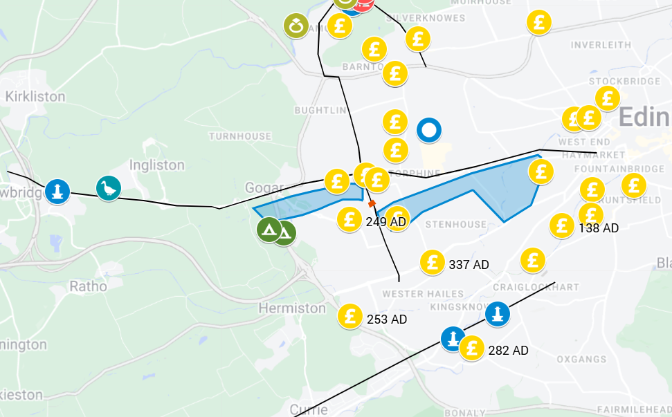
Corstorphine lies close to Cramond, where the Roman army built a fort during the Antonine occupation and returned during the Severan campaigns. Roads, inscriptions and reported coin finds help connect the area with this wider military landscape.
The Ingliston milestone
The milestone recorded at Ingliston names the First Cohort of Cugerni and gives a distance from Trimontium. Roman Inscriptions of Britain dates it to AD 140–144. It is evidence for Roman road activity in the area, but does not by itself prove the exact course beneath every section of modern St John’s Road or Glasgow Road.
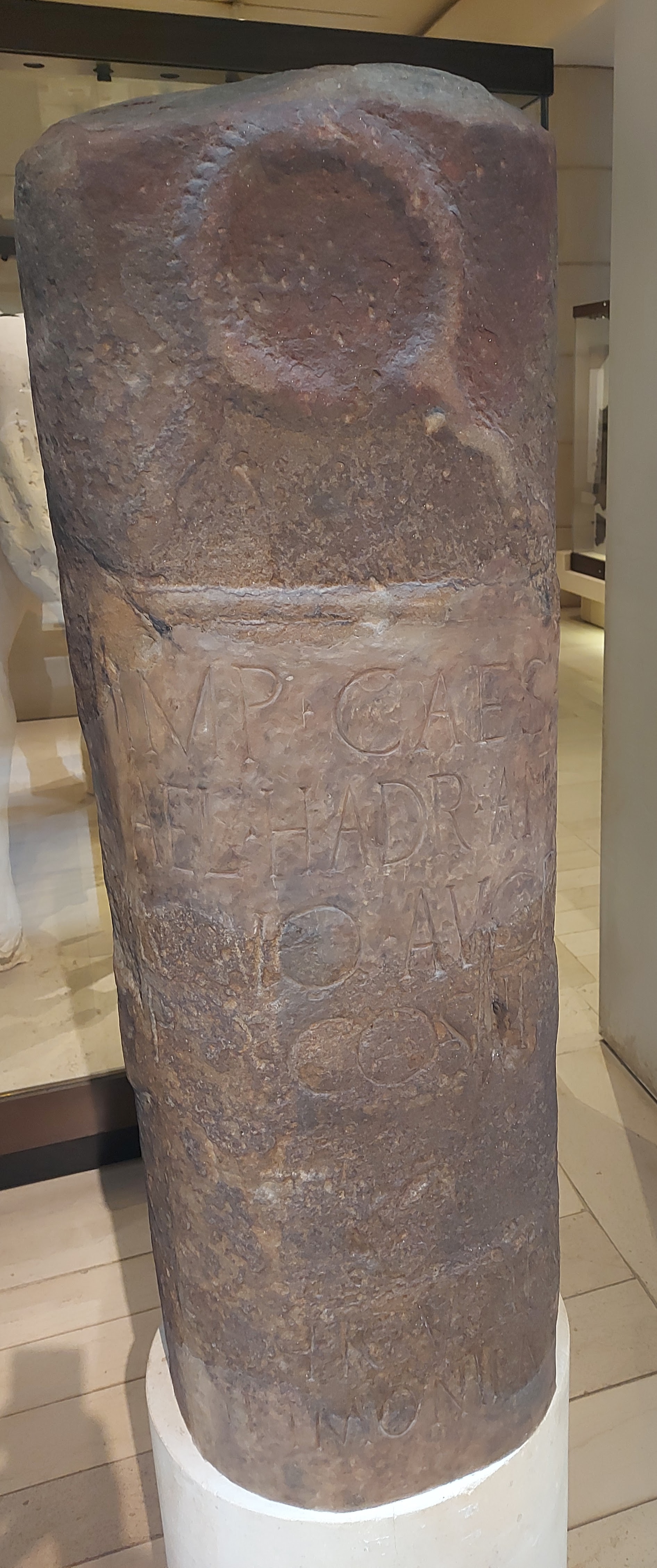
Read the inscription and its dating: RIB 2313
Coins and nearby camps
The Roman Corstorphine project mapped reported coin finds along St John’s Road and Glasgow Road, including near St Thomas’s Church and Drumbrae. These findspots are useful clues, but isolated coins do not prove a fort or date a road.
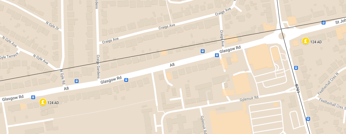
The original project also highlighted temporary camps near Edinburgh Park. Such evidence belongs to the wider local Roman landscape; it does not confirm that the Broomhall enclosure was Roman.
How strong is the Broomhall fort interpretation?
The enclosure’s shape, reported defences, possible roads and setting between former lochs prompted a Roman interpretation. However, Cormack’s 1958 report explicitly noted that no datable finds had been recovered. Shape and location alone cannot establish a Roman date. The original Roman Corstorphine comparison also noted a reported medieval bronze find and the risk of interpreting ambiguous marks to fit a preferred theory.
Status: possible, not confirmed. The aerial photographs and historical excavation reports below are evidence to investigate. They do not establish a Roman theatre, a particular garrison, or an imperial visit.
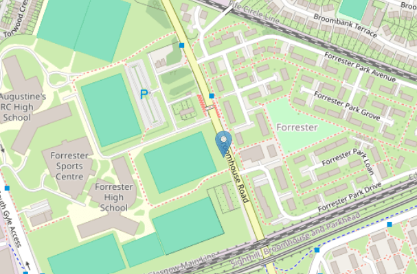
I visited the Local Heritage Centre in the Dower House Corstorphine run by The Corstorphine Trust and they have a map showing a Roman Road coming south from Cramond. When the Broomhall Estate was built remains of an old fort were found in what is now Broomhall Terrace.
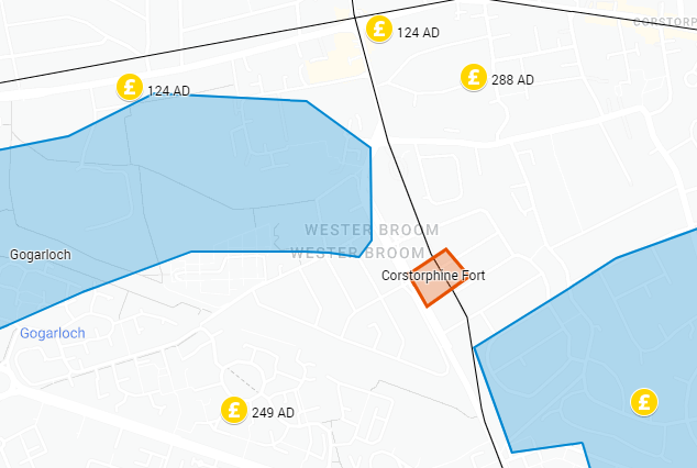
Discovery and Excavation Scotland 1958 By Dr E A Cormack
NT/194724. Recent building operations on the Broomhall estate have revealed evidence of a fort and a road.
The fort, of rectilinear outline and considerable extent, Iks on the S. bank of the former Gogar Loch. A substantial rampart and ditch have been seen in several cuttings through the N. and E. defences, and the structural features confirm the significance of linear crop marks seen on an air photograph in 1957. Although as yet no datable finds have been recovered, the evidence suggests the hitherto unsuspected presence of a Roman fort, linked by road with Cramond.
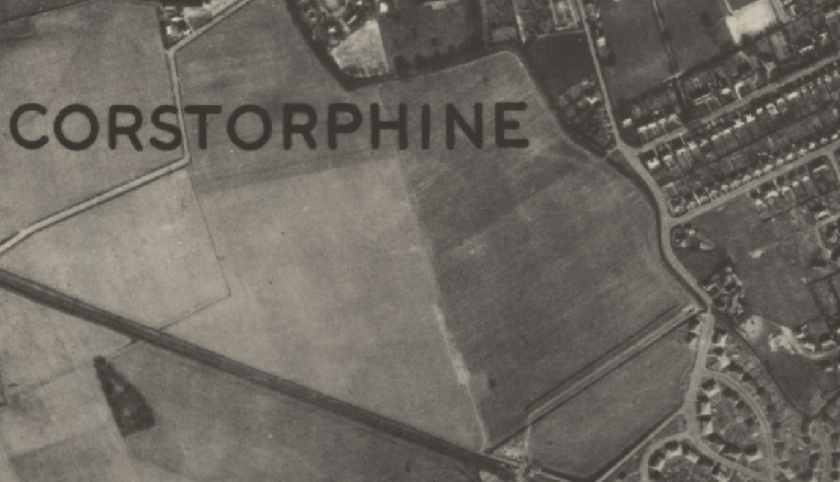
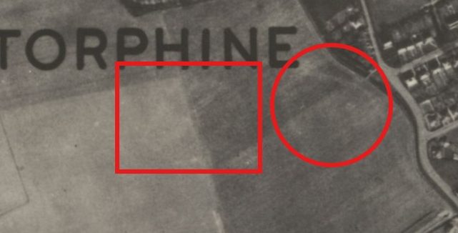
The road links Drumbrae Road with Broomhouse Road and includes a water crossing at the E. end of the former loch by a wooden bridge. A small ” pier ” (showing two phases of construction of the bridge) was found 4 ft. below the present surface, covered with peat sealed by a 9 ins. layer of clay deposited by the subsequent flooding of the loch, later drained and diminished since the 17th century. This discovery was made possible by the kind cooperation of Messrs Mactaggart and Mickel, Ltd., and their generous loan of a bulldozer.
A metalled causeway, -1 mile N. of the fort, crosses the line of the Drumbrae Road and has recently been traced K. across the S. flank of Corstorphine Hill, in alignment with a similar causeway exposed in the grounds of Donaldson’s Hospital and under the E. end of Eglinton Crescent, presumably an extension of the ancient ” Lang Gait ” and ” Fishwives’ Causeway ” leading to Inveresk.
Discovery and Excavation, Scotland, 1957 By Dr E A Cormack
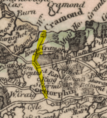
Eighteenth-century maps show the Drumbrae road as a direct route between Cramond and Corstorphine. A deep trench across the road for a sewer al NT/192738. and another longitudinal trench for a gas main, have shown the old road underlying three layers of modern metalling. “It is constructed of cobbles (and in parts of large boulders) firmly bedded in clay, it is cambered, with 7-9 ins depth of cobbles in the centre. The edges have been disturbed, but the section indicates a width of about 15 ft.
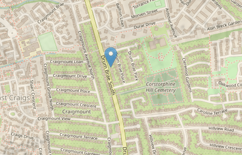
A similar trench across Broomhouse Road at NT/197717 shows an old road of the same type of construction, in alignment with Drumbrae Road, and presumably contemporary. Continuing the same line further S., there is a cambered ridge running across Kingsknowe Golf Course and continuing as a line of scattered cobbles in a ploughed field E. of Wester Hailes Farm. These and other indications suggest a straight road from Colinton to Cramond passing between the former lochs of Gogar and Corstorphine.