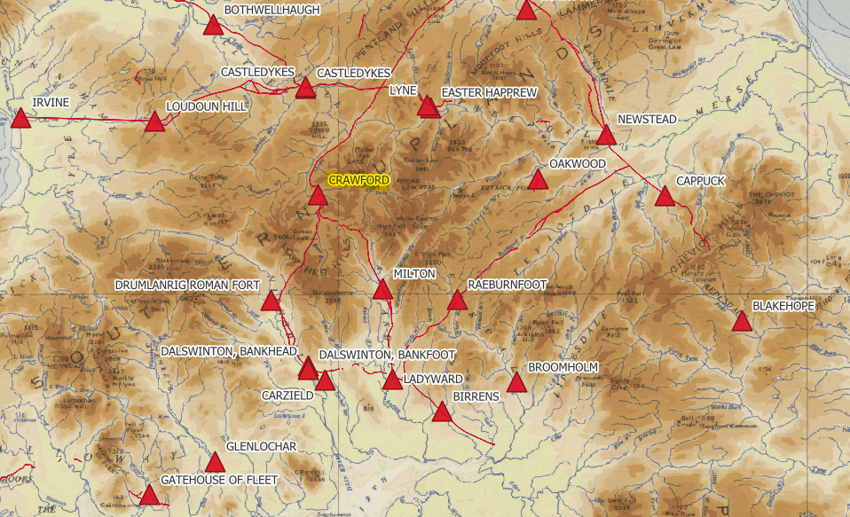
Crawford stands on the route linking the upper Clyde with the approaches to Annandale. Its Roman fort changed size and was occupied in separate periods, reflecting the army’s repeated need to secure movement across the Southern Uplands.
Visit Crawford
📍 Location: Crawford, South Lanarkshire, in the upper Clyde valley. Grid reference NS 954 214.
👁 What survives: Principally buried remains of successive forts.
⭐ Best for: Following the Roman route across the Southern Uplands.
🥾 Visit: A rural archaeological location. Use established routes and respect occupied properties and farmland.
🏛 Nearby Roman places: Castledykes to the north and Milton at Beattock to the south.
Crawford at a glance
| Feature | Evidence and interpretation |
|---|---|
| Occupation | Flavian, c. AD 80/81 to after 87; reoccupied around the AD 140s and finally abandoned about AD 165–170. |
| Garrison | Unidentified auxiliaries or detachments; the establishment changed with rebuilding. |
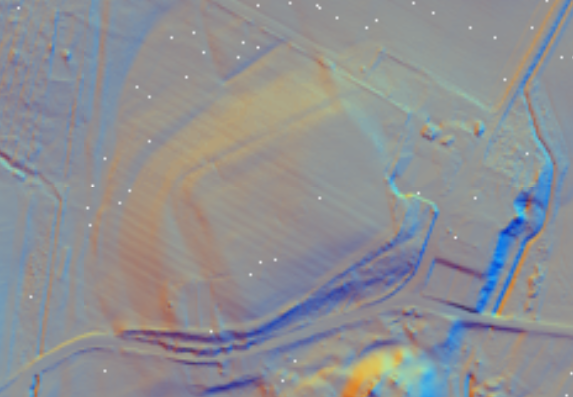
| Size | The smaller footprint used here is about 116 × 69 m: 0.80 hectares (1.98 acres). The fort was enlarged during the Antonine sequence. |
| Probable troop strength | Perhaps 250–300 for the smaller enclosure; about 500 is a published working estimate for the Antonine deployment. |
The first occupation
Gordon Maxwell’s excavation report places the initial fort around AD 80/81 and shows that occupation continued beyond AD 87. That is more informative than treating every Flavian fort as abandoned in precisely AD 86. The soldiers’ regiment is not identified, but the sequence belongs to the first Roman occupation of the north.
Return and enlargement
After an interval, the army returned in the Antonine period. Two main stages followed, with enlargement in the later one. The final withdrawal is placed around AD 165–170. Dismantled timber structures and discarded objects help archaeologists reconstruct the ending of occupation without requiring a dramatic siege or massacre.
Changing space, changing numbers
The supplied smaller footprint gives a rounded area-based estimate of about 280 men. Hodgson’s reconstruction allows about 500 at Antonine Crawford. These figures apply to different ways of assessing a changing site, rather than two precise counts of the same garrison. Roads, headquarters, storage and potentially horses all reduced the area available for sleeping accommodation.
Inscriptions and the identity of the troops
RIB 2494.92 records writing on an amphora from a Flavian ditch. The possible reading aq[ua], “water”, may indicate reuse of the container. It is evidence for everyday handling of supplies, not an inscription naming a cohort or cavalry regiment.
For the regiments and types of troops represented across Scotland, see Auxiliary units in Roman Scotland. The Roman Army guide explains the wider organisation, while Roman fort layout introduces the buildings found in permanent bases.
References and further reading
- Historic Environment Scotland: Crawford, NRHE 47396 — site record, archaeological notes and excavation bibliography.
- G. S. Maxwell (1974), ‘The Roman fort at Crawford, Lanarkshire’, PSAS 104, pp. 147–200
- RIB 2494.92: amphora inscription
- Nick Hodgson (2020), ‘Why was the Antonine Wall made of turf rather than stone?’, in The Antonine Wall: Papers in honour of Professor Lawrence Keppie, Appendix 1, p. 309; unit discussion p. 311 — hypothetical deployment model, consulted in the supplied volume.
- Roman Inscriptions of Britain: search Crawford — consult find contexts and commentary; a search result is not itself evidence for a garrison.
- Romans in Scotland fort-size spreadsheet — supplied copy used for dimensions and rounded capacity estimates, with archaeological measurements preferred where revised.
- Paul Holder (2003), ‘Auxiliary Deployment in the Reign of Hadrian’, especially p. 120 — nominal unit organisation, consulted in the supplied PDF; not a local garrison identification.

