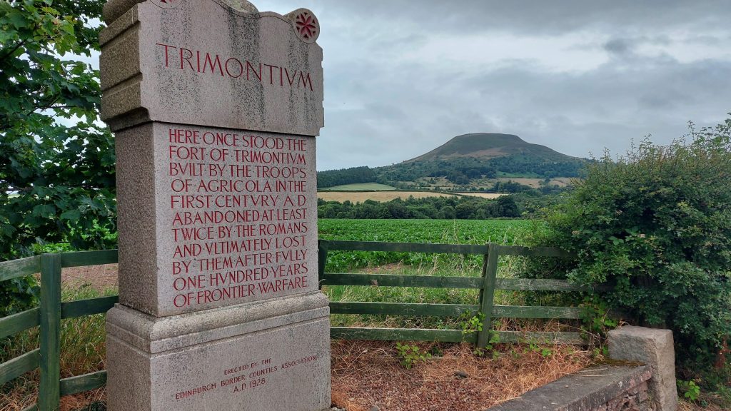
Discover the places where Rome left its mark on Scotland
Across Scotland, traces of the Roman army survive in the landscape.
Some are spectacular earthworks that can still be walked today. Others are almost invisible — forts, camps and roads whose outlines survive beneath fields, parks and modern towns.
Together they reveal more than a century of Roman campaigning, occupation and withdrawal.
Explore forts, fortlets, marching camps, roads, watchtowers and frontiers — and discover what survives at each site today.
🗺️ Find a Roman site near you
Roman remains can be found across much of Scotland, from the Borders and the Clyde–Forth corridor to Perthshire and beyond.
Use the interactive map to discover:
- forts
- fortlets
- temporary camps
- Roman roads
- museums
- inscriptions and finds
→ Find Romans Near You
🏰 Roman Forts
Where the Roman army lived
Forts formed the backbone of Roman occupation.
They controlled river crossings, roads and strategically important locations, while providing soldiers with barracks, headquarters, granaries, workshops and other facilities.
Some Scottish forts were occupied only briefly. Others were rebuilt or reoccupied during different Roman campaigns.
Important sites include:
Newstead • Birrens • Cramond • Inveresk • Ardoch • Strageath • Doune • Bertha • Camelon • Mumrills
Farther north stood the enormous legionary fortress at Inchtuthil, constructed during the campaigns associated with Agricola.
→ Explore Roman Forts in Scotland
→ Step inside a Roman Fort
🛡️ Fortlets
Small posts with an important role
Not every Roman garrison needed a full-sized fort.
Smaller fortlets housed detachments of soldiers who could watch roads, guard crossings and maintain control between larger military bases.
They are particularly important on the Antonine Wall, where archaeologists have identified a remarkable sequence of small installations.
Fortlets also occur elsewhere in Scotland, helping us reconstruct the Roman military network.
→ Explore Roman Fortlets in Scotland
⛺ Roman Camps
Follow armies on campaign
Scotland contains an extraordinary concentration of Roman temporary camps.
Unlike forts, these were not normally intended for long-term occupation. Soldiers could construct a defended enclosure while an army was:
- marching through hostile territory
- preparing for battle
- carrying out construction work
- assembling troops
- or returning to a strategically useful location
Many camps survive only as buried ditches revealed by aerial photography, cropmarks or geophysical survey.
Their distribution allows us to follow Roman armies deep into Scotland.
→ Explore Roman Camps in Scotland
→ Inside a Roman Marching Camp
🛣️ Roman Roads
The routes that connected Roman Scotland
Roman armies could not operate without reliable communications.
Roads linked:
forts • ports • supply bases • frontier installations • river crossings
Some Roman routes influenced later roads for centuries. Others have almost disappeared and survive only through excavation, aerial photography or subtle traces in the landscape.
Following the roads helps explain why forts and camps occur where they do.
→ Explore Roman Roads in Scotland
🧱 The Antonine Wall
Scotland’s great Roman frontier
Built from around AD 142, the Antonine Wall stretched across central Scotland between the Firth of Forth and the River Clyde.
It was far more than a wall.
The frontier included:
- a turf rampart
- a huge ditch
- the Military Way
- forts
- fortlets
- temporary construction camps
- bathhouses
- annexes
- civilian activity
- inscriptions and spectacular Distance Slabs
Today some of the best surviving Roman earthworks in Scotland can be explored along its route.
→ Explore the Antonine Wall
→ Visit the Antonine Wall
👁️ The Gask Ridge
Rome north of the later frontier
Long before the Antonine Wall was constructed, the Roman army established an extraordinary military landscape through Perthshire.
Along the route now known as the Gask Ridge were:
- forts
- fortlets
- watchtowers
- a Roman road
Sites such as Ardoch, Strageath and Bertha formed part of this wider military system.
Sections of the Roman route can still be explored on foot or by bicycle.
→ Explore the Gask Ridge Watchtowers
🏹 Beyond the frontiers
Roman activity did not stop at a wall.
During the campaigns associated with Agricola, Roman armies advanced deep into northern Scotland.
Later, the emperor Septimius Severus brought another enormous army north in AD 208–211.
Forts, roads and temporary camps therefore extend far beyond the Antonine Wall.
Explore sites connected with:
→ Agricola’s invasion
→ Inchtuthil Legionary Fortress
→ Roman campaigns in Scotland: timeline and map
→ Septimius Severus in Scotland
🔍 What can you actually see?
Roman sites in Scotland vary enormously.
At some places you can still walk beside impressive ramparts and ditches.
At others there may appear to be almost nothing there.
That doesn’t mean the archaeology has disappeared.
Beneath the ground may survive:
- fort ditches
- roads
- timber building foundations
- ovens
- pits
- bathhouses
- civilian settlements
Modern archaeology can reveal them using aerial photography, LiDAR, magnetometry, resistance survey and excavation.
Sometimes understanding what lies beneath your feet makes an apparently empty field much more interesting.
⭐ Where should I start?
Want the most impressive surviving sites?
→ Top 10 Roman Sites
Want somewhere near you?
→ Find Romans Near You
Interested in forts?
→ Roman Forts in Scotland
Want to follow a campaigning army?
→ Roman Camps in Scotland
Want to walk a Roman frontier?
→ Visit the Antonine Wall
Want to explore using maps?
→ Maps & GIS
Explore the Roman landscape
The individual ruins can sometimes seem isolated.
Put them together and a very different picture emerges.
Across Scotland the Romans created a vast military landscape of:
roads connecting forts
fortlets watching routes
camps marking advancing armies
watchtowers observing the countryside
and ultimately:
frontiers attempting to control the edge of the Roman Empire.

