Kirkintilloch lies directly on the Antonine Wall. Around the town and neighbouring hills, forts, roads, bathhouses and carved stones reveal how the frontier worked in practice.
Discover the Roman stories nearby
Bar Hill: the headquarters well
Shoes, tools and other objects recovered from a well illuminate life at the fort. The well stood in the headquarters courtyard, not the bathhouse.
Auchendavy: one soldier’s dedications
Read the altars associated with Marcus Cocceius Firmus. Inscriptions offer a personal perspective that the mostly buried fort cannot supply on the ground.
Explore the Roman sites map
Select the local map below to open the interactive view, then zoom or select a marker. Read the evidence notes below alongside it: a marker shows a recorded location or proposal, not proof that a Roman structure survives
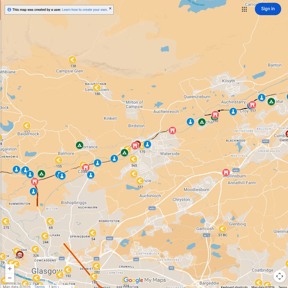
Open the interactive map full screen
What the evidence establishes
- Bar Hill and Auchendavy — established forts. Bar Hill has exposed foundations; Auchendavy’s buildings are principally buried.
- Kirkintilloch and Peel Park — established Roman military evidence; plan debated. Later development and overlapping remains limit a simple reconstruction of the whole fort.
- Bar Hill’s earlier enclosure — interpretation requires caution. Do not treat an earlier enclosure as proof of a separately dated Agricolan fort.
Why this area mattered
The frontier crossed a varied landscape here. Forts on high points could watch the Kelvin valley and communicate with neighbouring posts while the Military Way connected the garrisons.
Plan your visit: what survives today
- Bar Hill, above Twechar: an uphill walk reaches the headquarters remains, well and bathhouse. The official guide describes the approach; expect unsurfaced paths and uneven ground.
- Peel Park: a convenient town-centre stop to connect local interpretation with the Wall’s route. Most Roman structures are not exposed.
- Auchendavy: use the canal-side landscape and published plan for context; the altars are best explored through The Hunterian Museum and the linked article.
Sources, finds and further reading
Start with the local articles above, then follow the excavation reports, archaeological records and collections below. Historical reports preserve valuable evidence but may use interpretations revised by later work.
- Macdonald and Park (1906), the Roman forts on the Bar Hill — original excavation report
- Bar Hill archaeological record
- The Hunterian Museum — Bar Hill finds and Auchendavy altars.
- Antonine Wall visitor information
Continue exploring
- Visit the Antonine Wall
- Explore Roman altars
- Explore Roman inscriptions
- Verecunda at Shirva — a woman named on a tombstone near Auchendavy (RIB 2183). Her legal status and origins are unknown.
- Women in Roman Scotland — includes Bar Hill’s footwear and the women named in frontier inscriptions.
- Salamanes at Shirva — a fifteen-year-old commemorated on a tombstone; the name alone does not prove his birthplace.
- Marcus Cocceius Firmus — the Auchendavy altars and a possible connection with a woman mentioned in Roman legal evidence.
- The Auld Kirk Museum — a local museum route into Kirkintilloch’s history.

