The Antonine Wall crosses the Cumbernauld district through a landscape of ridges, valleys and modern development. Forts, fortlets and the Military Way once formed an interlocking frontier system.
Discover the Roman stories nearby
Westerwood: a fort under the modern landscape
Use the site record and altar evidence to explore a fort whose buildings are largely buried. The map is an orientation aid, not an excavation plan.
Castlecary: stone defences on a turf frontier
Castlecary was one of two Antonine Wall forts with stone defensive walls. Compare its surviving fragments and finds with the neighbouring posts.
Explore the Roman sites map
Select the local map below to open the interactive view, then zoom or select a marker. Read the evidence notes below alongside it: a marker shows a recorded location or proposal, not proof that a Roman structure survives
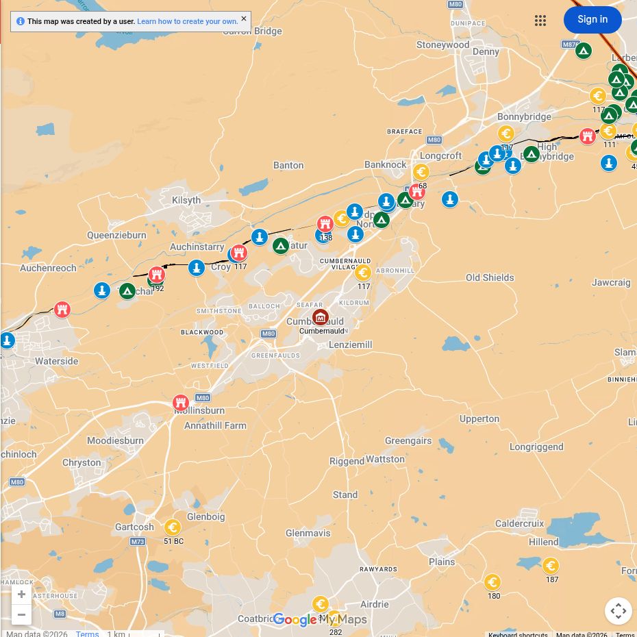
Open the interactive map full screen
What the evidence establishes
- Westerwood and Castlecary — established forts. Their plans come from archaeological investigation; modern fields, buildings and roads obscure much of the evidence.
- Croy Hill — established fort and Wall remains. The visible ditch and rock-cut sections belong to the frontier landscape, not a complete exposed fort.
- Garrison identities — evidence varies by site. Inscriptions record people or units, but a unit’s full paper strength is not a count of everyone stationed locally.
Why this area mattered
This central section linked the larger installations around Falkirk with forts farther west. High ground gave wide views, while roads had to negotiate burns and uneven terrain.
Plan your visit: what survives today
- Seabegs Wood: walk beside surviving stretches of the Wall ditch and Military Way. This is a woodland route with uneven surfaces, rather than an exposed fort.
- Croy Hill: choose this for walking along the frontier and understanding its difficult terrain. Expect a hill route and uneven grass.
- Castlecary: only parts of the Roman site survive visibly. Consult the official visit guide rather than following a map pin into private ground.
- Westerwood: principally a landscape visit. Do not expect an excavated fort open for inspection, and respect golf-course and farm activity.
Sources, finds and further reading
Start with the local articles above, then follow the excavation reports, archaeological records and collections below. Historical reports preserve valuable evidence but may use interpretations revised by later work.
- Castlecary archaeological record and excavation bibliography
- Hanson, Jones and Hannon (2024), Exploring the Antonine Wall with Terrestrial Remote Sensing — open survey monograph
- The Hunterian Museum — Wall collections, including local altars and building stones.
- Antonine Wall visitor information
Continue exploring
- Visit the Antonine Wall
- Roman leather
- Roman forts in Scotland
- Vibia Pacata at Westerwood — her altar records a dedication with her family (RIB 3504); a North African origin remains a suggestion, not an established birthplace.
- Women in Roman Scotland — connects Westerwood’s named dedication with footwear from Castlecary and Bar Hill.
- Bar Hill and Rough Castle: a filmed visit — compare two surviving Antonine Wall landscapes.

