The broad vale of Strathmore provided the Roman army with a natural route towards north-east Scotland. Around Brechin, forts and large temporary camps record movement during the northern campaigns.
Discover the Roman stories nearby
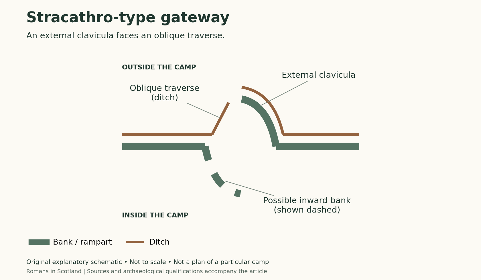
Stracathro: a fort and camps, not one enclosure
Explore the complex near Brechin. The distinctive gateway type takes its name from Stracathro, but its shape alone does not give an exact campaign date.
Cardean: following the Strathmore corridor
Look west towards another excavated fort at a river junction. Modern roads are useful for visiting, but should not be mistaken for a complete Roman route map.
Explore the Roman sites map
Select the local map below to open the interactive view, then zoom or select a marker. Read the evidence notes below alongside it: a marker shows a recorded location or proposal, not proof that a Roman structure survives
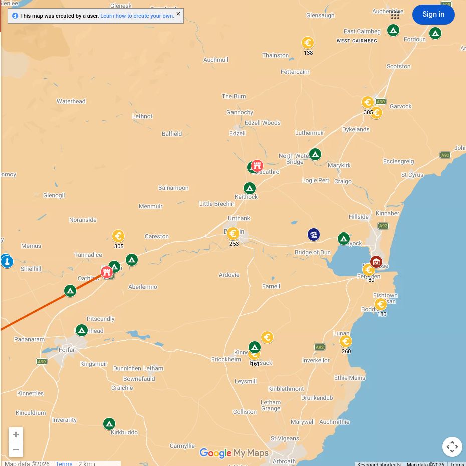
Open the interactive map full screen
What the evidence establishes
- Stracathro — established fort and temporary camps. The separate enclosures and their relationships matter more than a single label on a map.
- Cardean — established fort. It belongs to the wider Strathmore landscape, west of Brechin.
- Mons Graupius in Angus — proposed locations. Tacitus describes a battle; no suggested local battlefield should be presented as securely identified.
- Battledykes — a separate temporary camp in Angus. Its large enclosure belongs in the regional camp catalogue, rather than being merged with Stracathro fort.
Why this area mattered
The valley offered relatively level ground, water and access between the Tay basin and the Mearns. Control of its routes supported campaigning armies far beyond established bases.
Plan your visit: what survives today
- Stracathro: much of the archaeology is buried or known through cropmarks. Use the published plans and nearby public routes; do not expect a standing Roman fort beside the church.
- Cardean: make this a separate outing and consult the Cateran Ecomuseum site guide.
- For a visible camp landscape: consider Raedykes near Stonehaven as a further trip. Local museums can add regional context, but check Roman displays before travelling specifically for them.
Sources, finds and further reading
Start with the local articles above, then follow the excavation reports, archaeological records and collections below. Historical reports preserve valuable evidence but may use interpretations revised by later work.
- Stracathro archaeological record and excavation references
- Rebecca H. Jones (2011), Roman Camps in Scotland — Stracathro, its gateway form and the Angus camps.
- Cardean: geophysical survey report
- National Museums Scotland — Roman Scotland collections.
Continue exploring
- Inside a Roman marching camp
- Roman forts in Scotland
- Mons Graupius
- Roman marching camps with six gates — compare the layouts of larger camps.
- Dating Roman camps — background for assessing proposed campaign routes through Angus.

