Raedykes, north-west of Stonehaven, is one of the clearest surviving Roman camp landscapes in north-east Scotland. Its banks, ditches and gateways record a temporary military presence; they do not establish a Roman town or a securely identified battlefield.
Discover the Roman stories nearby
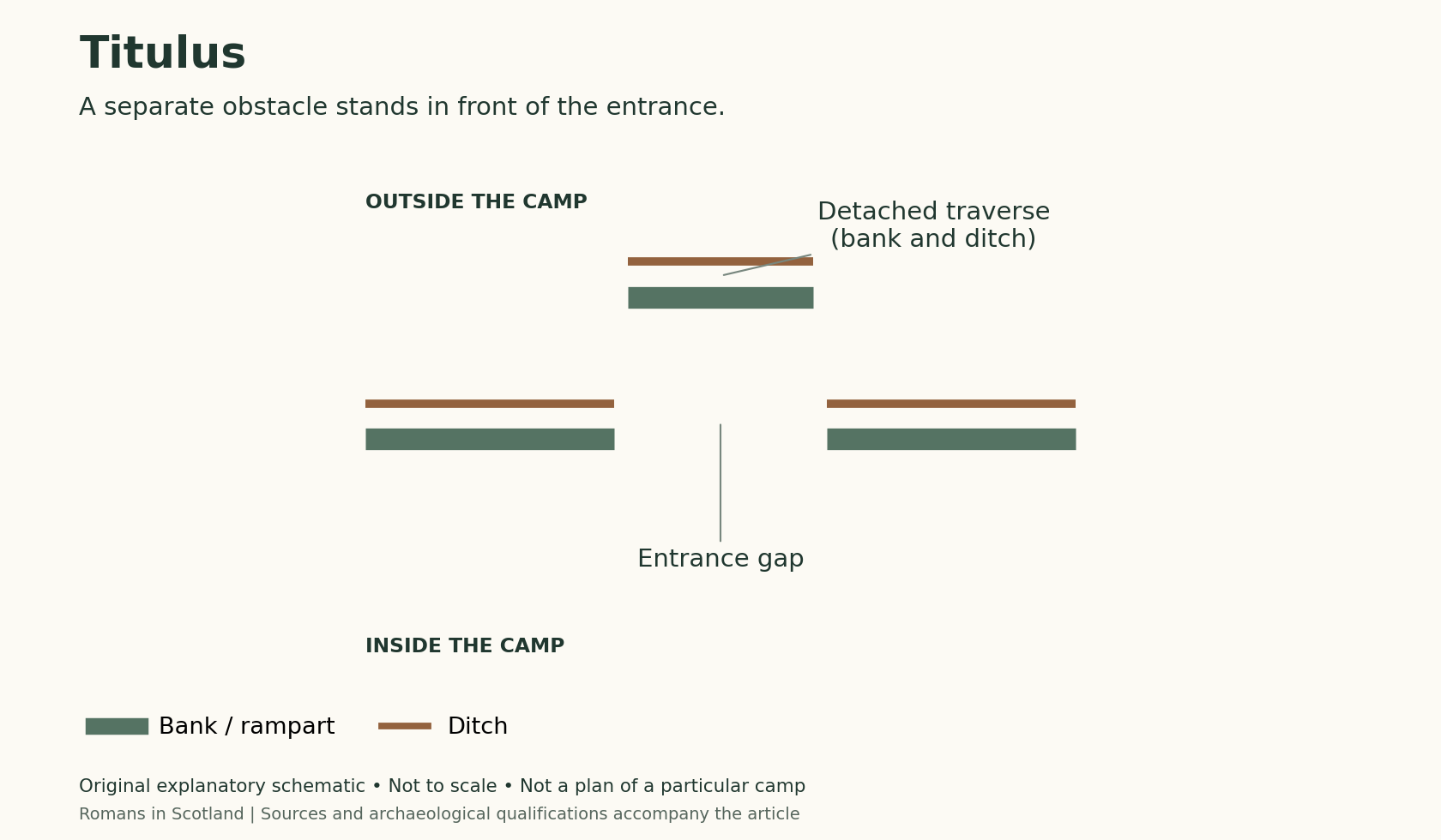
Raedykes: recognise a defended entrance
The surviving camp includes entrance outworks called tituli. This schematic explains the principle; use the archaeological record for Raedykes’s measured layout.
What happened inside a camp?
Compare Raedykes with the excavated ovens at Kintore. The gateway diagram explains a camp-defence principle; it is not a Kintore excavation plan.
Explore the Roman sites map
Select the local map below to open the interactive view, then zoom or select a marker. Read the evidence notes below alongside it: a marker shows a recorded location or proposal, not proof that a Roman structure survives
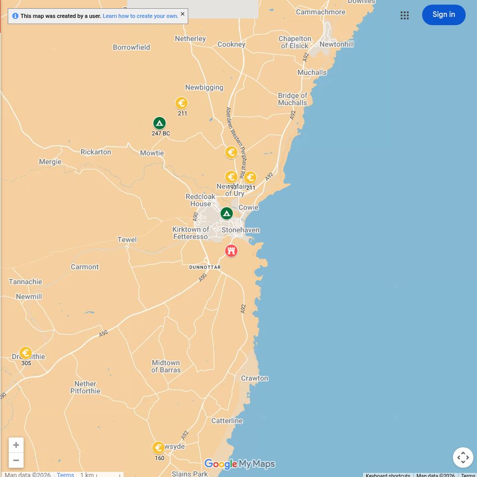
Open the interactive map full screen
What the evidence establishes
- Raedykes — established temporary camp with surviving earthworks. Its gates and defences can be recorded on the ground.
- Dating — interpretation rather than an inscribed event. A late-first-century origin has been proposed, but the camp should not be assigned an exact year from its shape alone.
- Mons Graupius — unlocated battlefield. The existence of Raedykes does not establish that the battle took place beside it.
Plan your visit: what survives today
- Raedykes: lies north-west of Stonehaven. Look for low banks, ditches and entrance features, not masonry buildings. Use an archaeological plan to make sense of the scale.
- Access: this is a working rural landscape with uneven ground. Plan the approach from mapped routes, respect livestock and crops, and do not assume a map pin indicates parking.
- Further exploration: Normandykes near Peterculter and Kintore make separate trips. Their buried evidence is often easier to understand through records than a casual walk.
Sources, finds and further reading
Start with the local articles above, then follow the excavation reports, archaeological records and collections below. Historical reports preserve valuable evidence but may use interpretations revised by later work.
- Aberdeenshire Historic Environment Record: Raedykes
- Historic Environment Scotland: Raedykes designation
- Macdonald (1916), Raedykes and Glenmailen — original investigation
- Rebecca H. Jones (2011), Roman Camps in Scotland — Raedykes catalogue entry and plan.
- National Museums Scotland — comparative Roman collections; check object findspots and current displays.
Continue exploring
- Inside a Roman marching camp
- Mons Graupius
- Explore Roman sites
- Roman marching camps with six gates — includes Raedykes among the comparative camp layouts.
- Dating Roman camps — explains the distinction between identifying a camp and assigning it to Agricola or Severus.

