Strathearn contains an exceptional concentration of Roman forts, camps, roads and watchtowers. Around Crieff and Auchterarder, the remains show armies establishing and reusing a route towards the Tay.
Discover the Roman stories nearby
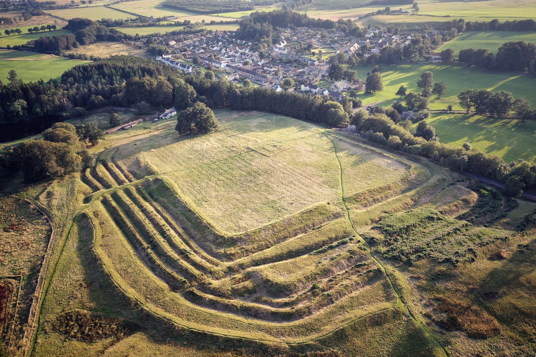
Ardoch: banks, ditches and rebuilding
Explore one of Scotland’s most substantial Roman earthwork sites. Its successive defences make more sense with a plan than with a single reconstruction.
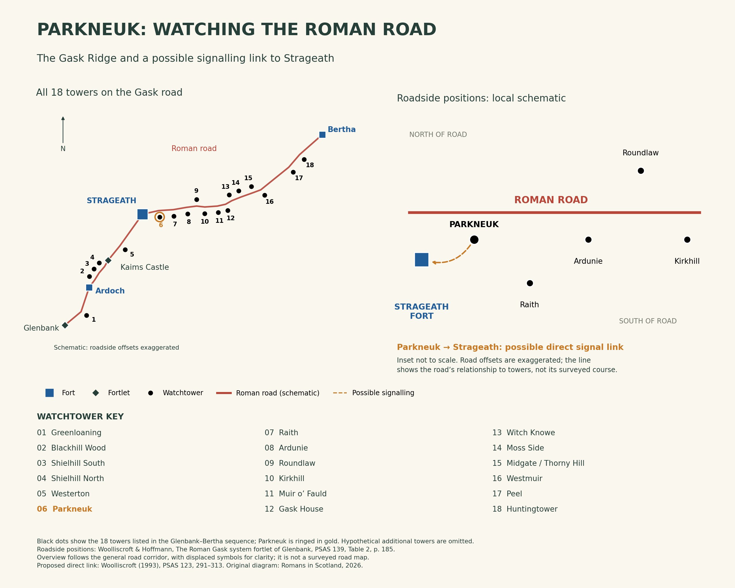
Gask towers: what could a lookout see?
Use Parkneuk to explore the spacing of towers and the signalling debate. The illustration is a modern schematic, not proof of a particular signal exchange.
Explore the Roman sites map
Select the local map below to open the interactive view, then zoom or select a marker. Read the evidence notes below alongside it: a marker shows a recorded location or proposal, not proof that a Roman structure survives
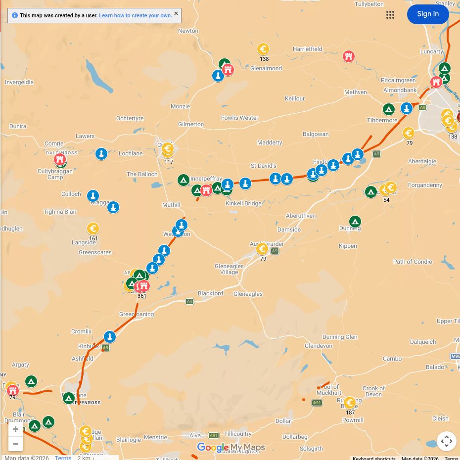
Open the interactive map full screen
What the evidence establishes
- Ardoch and Strageath — established forts. Excavation and survey document different occupation phases.
- Gask road, towers and fortlets — established remains with debated purpose and chronology. Their arrangement supports discussion of observation and communication; it does not identify every message or an exact construction year.
- Dunning camp — established camp, separately interpreted layout. A modern illustrative plan is not a measured archaeological survey.
Why this area mattered
The broad valley offered a practical northern corridor. Forts protected crossings and supplies, while smaller posts and towers watched movement along the road.
Plan your visit: what survives today
- Ardoch at Braco: the best starting point for visible earthworks. Allow time to read the successive banks and ditches; the grassy ground is uneven.
- Gask Ridge: choose a small number of recorded tower sites and check access separately. Survivals range from visible earthworks to buried features on working land.
- Strageath: chiefly a landscape and excavation-plan visit near the Earn. There is no complete stone fort laid out above ground. The Strageath article provides the archaeological context.
Sources, finds and further reading
Start with the local articles above, then follow the excavation reports, archaeological records and collections below. Historical reports preserve valuable evidence but may use interpretations revised by later work.
- Ardoch archaeological record
- Perth and Kinross research framework: Ardoch
- Woolliscroft: signalling and the design of the Gask system
- Roman Gask Project gazetteer and excavation reports
- RIB 2213: Ammonius’s tombstone from Ardoch
- National Museums Scotland — comparative Roman collections; check object findspots and current displays.
Continue exploring
- Roman forts in Scotland
- Explore Roman roads
- Explore Roman sites
- Julia of Strageath — the name IVLIA scratched on an amphora (RIB 2494.135). The find does not establish where the name was scratched or provide a biography.
- Women in Roman Scotland — places the Strageath name in the wider evidence for women and families.
- Sma’ Glen Roman watchtower — read with the Fendoch fort guide.
- Dunning Roman Camp: evidence of a second occupation — a nearby example of reuse without a securely established campaign date.

